
IMAGES TAKEN NEAR TO
Banks Road, CRAWLEY, RH10 7BJ
Introduction
This page details the photographs taken nearby to Banks Road, RH10 7BJ by members of the Geograph project.
The Geograph project started in 2005 with the aim of publishing, organising and preserving representative images for every square kilometre of Great Britain, Ireland and the Isle of Man.

There are currently over 7.5m images from over14,400 individuals and you can help contribute to the project by visiting https://www.geograph.org.uk
Image Map
Images are licensed for reuse under creativecommons.org/licenses/by-sa/2.0
Notes
- Clicking on the map will re-center to the selected point.
- The higher the marker number, the further away the image location is from the centre of the postcode.
Image Listing (105 Images Found)
Images are licensed for reuse under creativecommons.org/licenses/by-sa/2.0
Image
Details
Distance
1
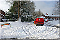
The mail gets through to Cowdray Close
There was no sign of the postman, so he was possibly doing the close, or the few houses down the bridleway/private drive behind the trees, on foot.
Image: © Robin Webster
Taken: 18 Dec 2009
0.04 miles
2
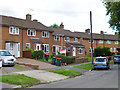
Houses on Knepp Close, Pound Hill, Crawley
A one-sided close, as there is a playing field opposite.
Image: © Robin Webster
Taken: 9 Aug 2013
0.05 miles
3
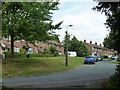
Banks Road, Pound Hill, Crawley
Viewed from the end of the lane up from the Worth Way trail.
Image: © Robin Webster
Taken: 8 Aug 2013
0.05 miles
5
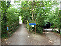
Cycleway flyover
The Worth Way, National Cycle route 21, carries straight on over the bridge following the old East Grinstead - Three Bridges railway line. Ramping down to the right is a connection to the Maidenbower - Pound Hill route passing under the bridge. The sign also suggests that is the way to National Cycle Route 20.
Image: © Robin Webster
Taken: 8 Aug 2013
0.06 miles
6
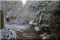
Bridleway from Pound Hill to Maidenbower, Crawley
Here passing under the old Three Bridges to East Grinstead railway, also now a bridleway. The bridge is hidden by the snowy trees. A ramp connecting the two heads left.
Image: © Robin Webster
Taken: 18 Dec 2009
0.06 miles
7
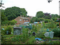
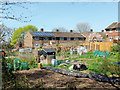
Allotments, Pound Hill, Crawley
Looking down from the old railway embankment used by the Worth Way trail.
Image: © Robin Webster
Taken: 8 Aug 2013
0.06 miles
8
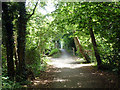
Worth Way, Crawley
Here the trail is using the course of the old Three Bridges - East Grinstead railway line, as it does for the majority of its route. Ahead is a crossing over a footpath and cycleway where the old railway bridge was removed, but replaced some good time later with a lightweight bridge.
Image: © Robin Webster
Taken: 8 Aug 2013
0.06 miles
9
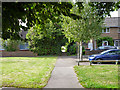
The end of Lewes Close, Pound Hill, Crawley
A few houses are round a small green on the left beyond the end of the actual road.
Image: © Robin Webster
Taken: 9 Aug 2013
0.06 miles
10
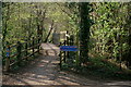
Worth Way
Seen at the location at which the Worth Way cycle route/footpath crosses over the route to Maidenbower.
Image: © Peter Trimming
Taken: 29 Mar 2019
0.06 miles