IMAGES TAKEN NEAR TO
Eridge Close, CRAWLEY, RH10 7BH
Introduction
This page details the photographs taken nearby to Eridge Close, RH10 7BH by members of the Geograph project.
The Geograph project started in 2005 with the aim of publishing, organising and preserving representative images for every square kilometre of Great Britain, Ireland and the Isle of Man.

There are currently over 7.5m images from over14,400 individuals and you can help contribute to the project by visiting https://www.geograph.org.uk
Image Map
Images are licensed for reuse under creativecommons.org/licenses/by-sa/2.0
Notes
- Clicking on the map will re-center to the selected point.
- The higher the marker number, the further away the image location is from the centre of the postcode.
Image Listing (106 Images Found)
Images are licensed for reuse under creativecommons.org/licenses/by-sa/2.0
Image
Details
Distance
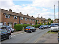
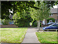
1
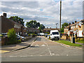
Eridge Close, Pound Hill, Crawley
A turning off Banks Road.
Image: © Robin Webster
Taken: 9 Aug 2013
0.02 miles
3
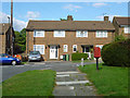
Houses on Spring Plat, Pound Hill, Crawley
The postbox is number RH10 87, on the corner with Banks Road.
Image: © Robin Webster
Taken: 9 Aug 2013
0.06 miles
4
Houses on Spring Plat, Pound Hill, Crawley
Opposite the end of The Pasture.
Image: © Robin Webster
Taken: 9 Aug 2013
0.06 miles
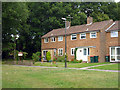
5
Houses on The Pasture, Pound Hill, Crawley
An estate of many interconnecting crescent shaped roads, this being one, making it confusing to navigate.
Image: © Robin Webster
Taken: 9 Aug 2013
0.06 miles
6
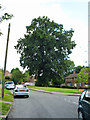
A large and stately oak
On a small green on The Pasture, Pound Hill, Crawley. Its tall mode of growth without much spread is not typical of native oak, yet a cursory look at the leaves indicated it was an oak species.
Image: © Robin Webster
Taken: 9 Aug 2013
0.07 miles
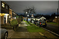
8
Lewes Close, Pound Hill, Crawley
This estate consists of a series of interconnected crescent roads with closes infilling the centre of the crescents.
Image: © Robin Webster
Taken: 10 Aug 2013
0.08 miles
9
The end of Lewes Close, Pound Hill, Crawley
A few houses are round a small green on the left beyond the end of the actual road.
Image: © Robin Webster
Taken: 9 Aug 2013
0.09 miles
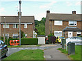
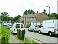
10
Houses on Bodiam Close, Pound Hill, Crawley
Facing a green beyond the vehicle accessible part of the close.
Image: © Robin Webster
Taken: 9 Aug 2013
0.10 miles