IMAGES TAKEN NEAR TO
Pearson Road, CRAWLEY, RH10 7AX
Introduction
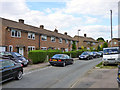
This page details the photographs taken nearby to Pearson Road, RH10 7AX by members of the Geograph project.
The Geograph project started in 2005 with the aim of publishing, organising and preserving representative images for every square kilometre of Great Britain, Ireland and the Isle of Man.

There are currently over 7.5m images from over14,400 individuals and you can help contribute to the project by visiting https://www.geograph.org.uk
Image Map
Images are licensed for reuse under creativecommons.org/licenses/by-sa/2.0
Notes
- Clicking on the map will re-center to the selected point.
- The higher the marker number, the further away the image location is from the centre of the postcode.
Image Listing (167 Images Found)
Images are licensed for reuse under creativecommons.org/licenses/by-sa/2.0
Image
Details
Distance
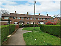
1
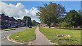
Three Bridges - Pearson Road at Alicia Avenue
Image: © Peter Whatley
Taken: 6 Jul 2023
0.03 miles
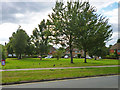
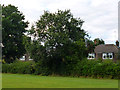
2
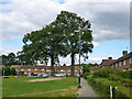
Trees and a goal
A green (except in front of the goal) on Pearson Road, Pound Hill, Crawley.
Image: © Robin Webster
Taken: 9 Aug 2013
0.03 miles
3
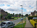
Pearson Road, Pound Hill, Crawley
The road running across the slope of the hill has meant the pavement here is above the road.
Image: © Robin Webster
Taken: 9 Aug 2013
0.05 miles
4
Three Bridges - public open space on Alicia Avenue
Image: © Peter Whatley
Taken: 6 Jul 2023
0.06 miles
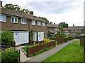
5
Houses on Clive Way, Pound Hill, Crawley
Image: © Robin Webster
Taken: 2 Apr 2021
0.08 miles
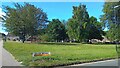
6
Green, Pearson Road, Pound Hill, Crawley
Appreciated by the crows.
Image: © Robin Webster
Taken: 9 Aug 2013
0.08 miles
7
Houses on Arundel Close, Pound Hill, Crawley
These are on a walk quite remote from the vehicle accessible part of the close.
Image: © Robin Webster
Taken: 9 Aug 2013
0.09 miles
8
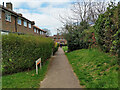
Path, Clive Way, Pound Hill, Crawley
Many of the houses on Clive Way are reached via paths.
Image: © Robin Webster
Taken: 2 Apr 2021
0.09 miles
9
Houses on The Pasture, Pound Hill, Crawley
An estate of many interconnecting crescent shaped roads, this being one, making it confusing to navigate.
Image: © Robin Webster
Taken: 9 Aug 2013
0.09 miles
10
Tree, Knepp Close playing field, Pound Hill, Crawley
Beyond are houses on Hatings Road.
Image: © Robin Webster
Taken: 9 Aug 2013
0.09 miles