
IMAGES TAKEN NEAR TO
Hudson Road, CRAWLEY, RH10 5NR
Introduction
This page details the photographs taken nearby to Hudson Road, RH10 5NR by members of the Geograph project.
The Geograph project started in 2005 with the aim of publishing, organising and preserving representative images for every square kilometre of Great Britain, Ireland and the Isle of Man.

There are currently over 7.5m images from over14,400 individuals and you can help contribute to the project by visiting https://www.geograph.org.uk
Image Map
Images are licensed for reuse under creativecommons.org/licenses/by-sa/2.0
Notes
- Clicking on the map will re-center to the selected point.
- The higher the marker number, the further away the image location is from the centre of the postcode.
Image Listing (40 Images Found)
Images are licensed for reuse under creativecommons.org/licenses/by-sa/2.0
Image
Details
Distance
1
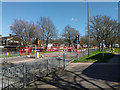
Road block, Hawth Avenue, Crawley
The road was up further along, but access to residential side turnings was allowed for from the other end.
Image: © Robin Webster
Taken: 24 Mar 2019
0.04 miles
2
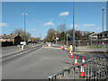
A2004 Southgate Avenue, Crawley
Looking towards the town centre, with a closed Hawth Avenue to the right. Trenching work was going on.
Image: © Robin Webster
Taken: 24 Mar 2019
0.08 miles
3
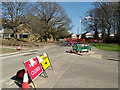
Road up on Hawth Avenue, Crawley
The road was closed to through traffic, although access to the residential roads off it had to be maintained.
Image: © Robin Webster
Taken: 24 Mar 2019
0.09 miles
4
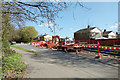
Road up on Hawth Avenue, Crawley
The road was closed to through traffic, although access to the residential roads off it had to be maintained.
Image: © Robin Webster
Taken: 24 Mar 2019
0.12 miles
5
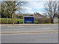
Southbound Southgate Avenue North bus stop, Crawley
Image: © Robin Webster
Taken: 7 Mar 2021
0.12 miles
6
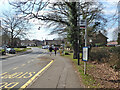
Southgate Drive, Southgate, Crawley
The bus stop is called Southgate Avenue, served by Route 1 towards the town centre.
Image: © Robin Webster
Taken: 7 Mar 2021
0.13 miles
7
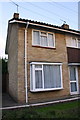
#35 Southgate Drive
There is an Ordnance Survey benchmark Image on the left hand side of the house near the front corner
Image: © Roger Templeman
Taken: 19 Sep 2015
0.15 miles
8
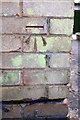
Benchmark on #35 Southgate Drive
Ordnance Survey cut mark benchmark described on the Bench Mark Database at http://www.bench-marks.org.uk/bm70699
Image: © Roger Templeman
Taken: 19 Sep 2015
0.15 miles
9
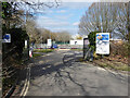
Entrance to St Philip Howard Centre, Southgate Drive, Crawley
A Roman Catholic agency, mentioning on the sign the primary school and pre-school on this site, but something else as well. 'Education, formation and mission' it says, it welcomes you in, but does not let you out without a pass.
Image: © Robin Webster
Taken: 7 Mar 2021
0.15 miles
10
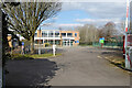
St Francis of Assisi Catholic Primary School, Crawley
Image: © Robin Webster
Taken: 7 Mar 2021
0.15 miles