IMAGES TAKEN NEAR TO
Gage Close, CRAWLEY, RH10 4XS
Introduction
This page details the photographs taken nearby to Gage Close, RH10 4XS by members of the Geograph project.
The Geograph project started in 2005 with the aim of publishing, organising and preserving representative images for every square kilometre of Great Britain, Ireland and the Isle of Man.

There are currently over 7.5m images from over14,400 individuals and you can help contribute to the project by visiting https://www.geograph.org.uk
Image Map
Images are licensed for reuse under creativecommons.org/licenses/by-sa/2.0
Notes
- Clicking on the map will re-center to the selected point.
- The higher the marker number, the further away the image location is from the centre of the postcode.
Image Listing (25 Images Found)
Images are licensed for reuse under creativecommons.org/licenses/by-sa/2.0
Image
Details
Distance
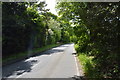
2
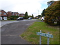
Tiltwood Drive seen from the junction with Aviary Way
Image: © Shazz
Taken: 9 Oct 2016
0.08 miles
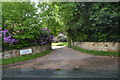
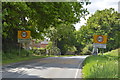
4
By Appointment to The Queen (Chimney Sweep)
Image: © N Chadwick
Taken: 23 May 2016
0.12 miles
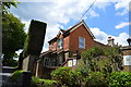
7
By Appointment
See also http://www.geograph.org.uk/photo/5117327 for a photograph taken the previous month.
Image: © Shazz
Taken: 9 Oct 2016
0.13 miles