IMAGES TAKEN NEAR TO
Paddockhurst Road, CRAWLEY, RH10 4SA
Introduction
This page details the photographs taken nearby to Paddockhurst Road, RH10 4SA by members of the Geograph project.
The Geograph project started in 2005 with the aim of publishing, organising and preserving representative images for every square kilometre of Great Britain, Ireland and the Isle of Man.

There are currently over 7.5m images from over14,400 individuals and you can help contribute to the project by visiting https://www.geograph.org.uk
Image Map
Images are licensed for reuse under creativecommons.org/licenses/by-sa/2.0
Notes
- Clicking on the map will re-center to the selected point.
- The higher the marker number, the further away the image location is from the centre of the postcode.
Image Listing (20 Images Found)
Images are licensed for reuse under creativecommons.org/licenses/by-sa/2.0
Image
Details
Distance
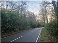
1
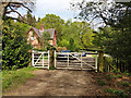
End of bridleway from Parish Lane, Pease Pottage
Here it joins Paddockhurst Road, B2110.
Image: © Robin Webster
Taken: 22 Apr 2019
0.02 miles
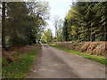
2
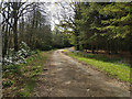
Bridleway towards Pease Pottage
This first section from Paddockhurst Road to Balcombe Road is an estate tarmac road.
Image: © Robin Webster
Taken: 22 Apr 2019
0.06 miles
3
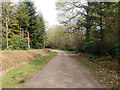
Bridleway from Pease Pottage
This last section from Balcombe Road to Paddockhurst Road is an estate tarmac road.
Image: © Robin Webster
Taken: 22 Apr 2019
0.06 miles
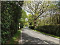
5
Exploring eastwards along the Bashire (41)
Looking north-northeast along the B2110
Image: © Basher Eyre
Taken: 29 Dec 2023
0.13 miles
6
Bridleway towards Pease Pottage
This first section from Paddockhurst Road to Balcombe Road is an estate tarmac road.
Image: © Robin Webster
Taken: 22 Apr 2019
0.14 miles
7
Paddockhurst Road, B2110
Looking towards Turners Hill. There is no footway, so it is an uncomfortable six minutes or so getting from the footpath at Worth School to the start of the bridleway towards Pease Pottage or vice versa.
Image: © Robin Webster
Taken: 22 Apr 2019
0.15 miles
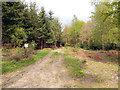
8
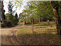
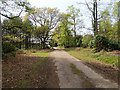
Track junction, Whitely Hill
Most of the tracks are private.
Image: © Robin Webster
Taken: 22 Apr 2019
0.16 miles
9
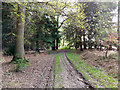
Woodland track, Whitely Hill
Going into Bennett's Rough.
Image: © Robin Webster
Taken: 22 Apr 2019
0.16 miles
10
Bridleway towards Pease Pottage
This first section from Paddockhurst Road to Balcombe Road is an estate tarmac road.
Image: © Robin Webster
Taken: 22 Apr 2019
0.17 miles