IMAGES TAKEN NEAR TO
Willow Ridge, CRAWLEY, RH10 4PN
Introduction
This page details the photographs taken nearby to Willow Ridge, RH10 4PN by members of the Geograph project.
The Geograph project started in 2005 with the aim of publishing, organising and preserving representative images for every square kilometre of Great Britain, Ireland and the Isle of Man.

There are currently over 7.5m images from over14,400 individuals and you can help contribute to the project by visiting https://www.geograph.org.uk
Image Map
Images are licensed for reuse under creativecommons.org/licenses/by-sa/2.0
Notes
- Clicking on the map will re-center to the selected point.
- The higher the marker number, the further away the image location is from the centre of the postcode.
Image Listing (52 Images Found)
Images are licensed for reuse under creativecommons.org/licenses/by-sa/2.0
Image
Details
Distance
1
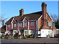
The Crown, Turners Hill
The Crown sits on the crown of the hill in the Wealden village.
Image: © Colin Smith
Taken: 5 Apr 2010
0.07 miles
2
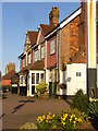
Spring Evening Sunshine at The Crown
Tile-hung pub at the hilltop crossroads in the Sussex village of Turners Hill.
Image: © Colin Smith
Taken: 5 Apr 2010
0.07 miles
3
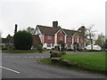
The Crown at Turners Hill
By the junction of the B2028 and B2110.
Image: © Dave Spicer
Taken: 24 Oct 2012
0.07 miles
4
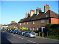
East Street, Turners Hill
Red brick cottages lining the road east from the hilltop crossroads at Turners Hill in the High Weald.
Image: © Colin Smith
Taken: 5 Apr 2010
0.07 miles
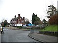
6
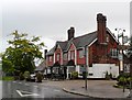
The Crown public house, Turner's Hill
Image: © nick macneill
Taken: 28 Sep 2012
0.07 miles
7
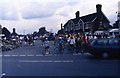
Charity cycle ride passing through Turners Hill (4)
Image: © Peter Shimmon
Taken: 16 Jun 1991
0.08 miles
8
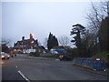
Crossroads in Turners Hill
Looking towards The Crown pub
Image: © David Howard
Taken: 6 Feb 2017
0.09 miles
9
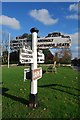
Old Direction Sign - Signpost by the B2028 at Turners Hill
Black iron cap finial - 4 arms; East Sussex wood with number by the B2028, in parish of Turners Hill (Mid Sussex District), where the B2110 - Church Road and East Street cross the B2028, on verge at crossroads (NE corner).
Surveyed
Milestone Society National ID: SX_TQ3435.
Image: © Milestone Society
Taken: Unknown
0.09 miles