IMAGES TAKEN NEAR TO
Sunnyhill Close, CRAWLEY, RH10 4GY
Introduction
This page details the photographs taken nearby to Sunnyhill Close, RH10 4GY by members of the Geograph project.
The Geograph project started in 2005 with the aim of publishing, organising and preserving representative images for every square kilometre of Great Britain, Ireland and the Isle of Man.

There are currently over 7.5m images from over14,400 individuals and you can help contribute to the project by visiting https://www.geograph.org.uk
Image Map
Images are licensed for reuse under creativecommons.org/licenses/by-sa/2.0
Notes
- Clicking on the map will re-center to the selected point.
- The higher the marker number, the further away the image location is from the centre of the postcode.
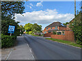
Image Listing (58 Images Found)
Images are licensed for reuse under creativecommons.org/licenses/by-sa/2.0
Image
Details
Distance
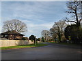
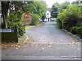
1
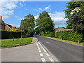
Vicarage Road, Crawley Down
Buckley Place on the left.
Image: © Robin Webster
Taken: 20 May 2023
0.03 miles
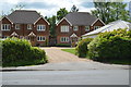
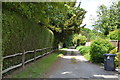
3
Station Road joins Vicarage Road, Crawley Down
Image: © Robin Webster
Taken: 20 May 2023
0.04 miles
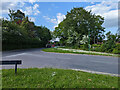
6
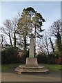
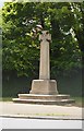
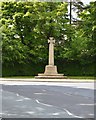
Crawley Down War Memorial: mid December 2015
Image: © Basher Eyre
Taken: 19 Dec 2015
0.05 miles