IMAGES TAKEN NEAR TO
Rushetts Close, CRAWLEY, RH10 4AX
Introduction
This page details the photographs taken nearby to Rushetts Close, RH10 4AX by members of the Geograph project.
The Geograph project started in 2005 with the aim of publishing, organising and preserving representative images for every square kilometre of Great Britain, Ireland and the Isle of Man.

There are currently over 7.5m images from over14,400 individuals and you can help contribute to the project by visiting https://www.geograph.org.uk
Image Map (Loading...)


Getting Data...Please wait
Leaflet Map data © OpenStreetMap
Images are licensed for reuse under creativecommons.org/licenses/by-sa/2.0
Notes
- Clicking on the map will re-center to the selected point.
- The higher the marker number, the further away the image location is from the centre of the postcode.
Image Listing (43 Images Found)
Images are licensed for reuse under creativecommons.org/licenses/by-sa/2.0
Image
Details
Distance
2
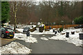
Cob Close, Crawley Down
Used by the Worth Way to regain the route of the old railway line after interruption by housing development.
Image: © Robin Webster
Taken: 15 Jan 2010
0.12 miles
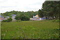
4
Field north of Burleigh Lane, Crawley Down
Really the 'garden' of a large house off to the left. At the far side, the next field is being built on in the latest spread south of the large fairly modern residential part of Crawley Down.
Image: © Robin Webster
Taken: 22 Sep 2021
0.14 miles
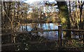
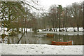
5
Ducks on Crawley Down Pond
Taken from Worth Way looking north
Image: © Simon Carey
Taken: 27 Aug 2005
0.14 miles
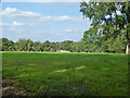
6
Hazel Way
Hazel Way curves away from the junction with the short Cob Close to the right foreground. The latter takes the Worth Way back to the course of the old railway line.
Image: © Robin Webster
Taken: 15 Jan 2010
0.14 miles
7
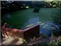
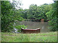
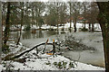
Pond beside the Worth Way
A pond on the outskirts of Crawley Down
Image: © Chris Thomas-Atkin
Taken: 28 Dec 2017
0.15 miles
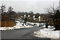
10
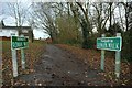
Footpath to Rowan Walk, Crawley Down
Just in case you weren't sure, this is the footpath to Rowan Walk, Crawley Down - in keeping with the Geograph rules, no digital enhancement used!
Image: © CDSnapper
Taken: 23 Nov 2008
0.16 miles