
IMAGES TAKEN NEAR TO
Crosswater Road, RH10 3WD
Introduction
This page details the photographs taken nearby to Crosswater Road, RH10 3WD by members of the Geograph project.
The Geograph project started in 2005 with the aim of publishing, organising and preserving representative images for every square kilometre of Great Britain, Ireland and the Isle of Man.

There are currently over 7.5m images from over14,400 individuals and you can help contribute to the project by visiting https://www.geograph.org.uk
Image Map
Images are licensed for reuse under creativecommons.org/licenses/by-sa/2.0
Notes
- Clicking on the map will re-center to the selected point.
- The higher the marker number, the further away the image location is from the centre of the postcode.
Image Listing (85 Images Found)
Images are licensed for reuse under creativecommons.org/licenses/by-sa/2.0
Image
Details
Distance
1
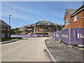
Building site, Forge Wood, Crawley
The latest expansion of the Forge Wood neighbourhood, north of Steers Lane. It seems to be called Riverbrook Place.
Image: © Robin Webster
Taken: 29 May 2023
0.04 miles
2
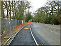
Steers Lane, 2015
Steers Lane was closed to through traffic for improvements to do with the development of the new Forge Wood Crawley neighbourhood. Traffic was diverted via Radford Road.
Image: © Robin Webster
Taken: 1 Jan 2015
0.04 miles
3
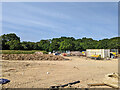
Building site, Forge Wood, Crawley
The latest expansion of the Forge Wood neighbourhood, north of Steers Lane. It seems to be called Riverbrook Place.
Image: © Robin Webster
Taken: 29 May 2023
0.05 miles
4
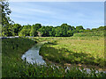
Balancing pond, Riverbrook Place, Forge Wood, Crawley
For the latest phase of development north of Steers Lane.
Image: © Robin Webster
Taken: 29 May 2023
0.05 miles
5
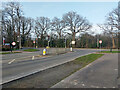
Traffic lights, Somerley Drive - Steers Lane junction
This T junction will be converted into a crossroads when a development for 185 homes starts on the land across the road.
Image: © Robin Webster
Taken: 21 Feb 2021
0.05 miles
6
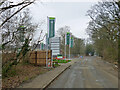
Steers Lane at Forge Wood site entrance, 2015
Steers Lane was closed for improvements to do with the development of the new Forge Wood Crawley neighbourhood. Traffic was diverted via Radford Road.
Image: © Robin Webster
Taken: 1 Jan 2015
0.05 miles
7
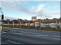
Building site north of Steers Lane
'Riverbrook Place' has started. A rather large number of houses.
Image: © Robin Webster
Taken: 28 Nov 2021
0.05 miles
8
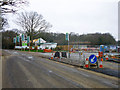
Building site on Steers Lane
Steers Lane has been closed for some time whilst changes are made to improve things for the new Forge Wood housing development here. This is the main site entrance.
Image: © Robin Webster
Taken: 1 Jan 2015
0.06 miles
9
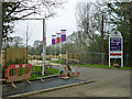
Forge Wood - entrance, marketing suite and show homes. 2015
This was for the Taylor Wimpey part of the development, the other developer, Persimmon, had a similar set-up further down the road.
Image: © Robin Webster
Taken: 1 Jan 2015
0.06 miles
10
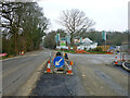
Steers Lane at Forge Wood site entrance, 2015
Steers Lane was closed to through traffic for improvements to do with the development of the new Forge Wood Crawley neighbourhood. Traffic was diverted via Radford Road.
Image: © Robin Webster
Taken: 1 Jan 2015
0.06 miles