IMAGES TAKEN NEAR TO
Church Lane, CRAWLEY, RH10 3QG
Introduction
This page details the photographs taken nearby to Church Lane, RH10 3QG by members of the Geograph project.
The Geograph project started in 2005 with the aim of publishing, organising and preserving representative images for every square kilometre of Great Britain, Ireland and the Isle of Man.

There are currently over 7.5m images from over14,400 individuals and you can help contribute to the project by visiting https://www.geograph.org.uk
Image Map
Images are licensed for reuse under creativecommons.org/licenses/by-sa/2.0
Notes
- Clicking on the map will re-center to the selected point.
- The higher the marker number, the further away the image location is from the centre of the postcode.
Image Listing (51 Images Found)
Images are licensed for reuse under creativecommons.org/licenses/by-sa/2.0
Image
Details
Distance
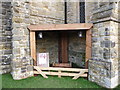
1
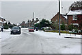
Church Lane at Akehurst Close, Copthorne
Waste bins have been left out, but it will be some time before they are emptied in this weather.
Image: © Robin Webster
Taken: 11 Jan 2010
0.04 miles
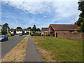
3
Beechey Close, Copthorne
A turning off Knowle Drive.
Image: © Robin Webster
Taken: 13 Jul 2022
0.17 miles
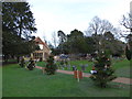
4
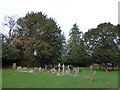
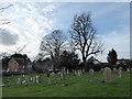
St John the Evangelist, Copthorne: churchyard (viii)
Image: © Basher Eyre
Taken: 19 Dec 2015
0.18 miles
5
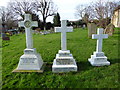
St John the Evangelist, Copthorne: churchyard (iv)
Image: © Basher Eyre
Taken: 19 Dec 2015
0.18 miles
6
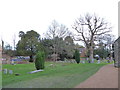
St John the Evangelist, Copthorne: churchyard (iii)
Image: © Basher Eyre
Taken: 19 Dec 2015
0.18 miles
7
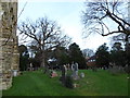
St John the Evangelist, Copthorne: churchyard (ii)
Image: © Basher Eyre
Taken: 19 Dec 2015
0.18 miles
8
St John the Evangelist, Copthorne: churchyard (v)
Image: © Basher Eyre
Taken: 19 Dec 2015
0.18 miles
9
St John the Evangelist, Copthorne: churchyard (vi)
Image: © Basher Eyre
Taken: 19 Dec 2015
0.18 miles
10
St John the Evangelist, Copthorne: churchyard (vii)
Image: © Basher Eyre
Taken: 19 Dec 2015
0.18 miles