IMAGES TAKEN NEAR TO
Copthorne Bank, CRAWLEY, RH10 3JD
Introduction
This page details the photographs taken nearby to Copthorne Bank, RH10 3JD by members of the Geograph project.
The Geograph project started in 2005 with the aim of publishing, organising and preserving representative images for every square kilometre of Great Britain, Ireland and the Isle of Man.

There are currently over 7.5m images from over14,400 individuals and you can help contribute to the project by visiting https://www.geograph.org.uk
Image Map (Loading...)


Getting Data...Please wait
Leaflet Map data © OpenStreetMap
Images are licensed for reuse under creativecommons.org/licenses/by-sa/2.0
Notes
- Clicking on the map will re-center to the selected point.
- The higher the marker number, the further away the image location is from the centre of the postcode.
Image Listing (19 Images Found)
Images are licensed for reuse under creativecommons.org/licenses/by-sa/2.0
Image
Details
Distance
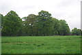
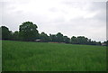
3
Field near Allingham Farm
Field of horses near to Allingham Farm. Overhead a plane is on its approach to landing at Gatwick Airport.
Image: © Chris Thomas-Atkin
Taken: 28 Dec 2017
0.12 miles
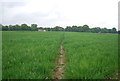
4
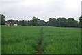
Tandridge Border Path crossing a wheat field
Image: © N Chadwick
Taken: 30 May 2013
0.13 miles
7
Tandridge Border Path crossing a wheat field
Image: © N Chadwick
Taken: 30 May 2013
0.16 miles
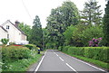
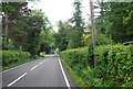
10
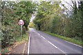
Road in a rural area
Taken from TQ322400 looking almost north shows the smaller of two roads in the square, which is very rural.
Image: © SGBailey
Taken: 7 Nov 2005
0.19 miles