IMAGES TAKEN NEAR TO
St. Marys Drive, CRAWLEY, RH10 3BQ
Introduction
This page details the photographs taken nearby to St. Marys Drive, RH10 3BQ by members of the Geograph project.
The Geograph project started in 2005 with the aim of publishing, organising and preserving representative images for every square kilometre of Great Britain, Ireland and the Isle of Man.

There are currently over 7.5m images from over14,400 individuals and you can help contribute to the project by visiting https://www.geograph.org.uk
Image Map
Images are licensed for reuse under creativecommons.org/licenses/by-sa/2.0
Notes
- Clicking on the map will re-center to the selected point.
- The higher the marker number, the further away the image location is from the centre of the postcode.
Image Listing (56 Images Found)
Images are licensed for reuse under creativecommons.org/licenses/by-sa/2.0
Image
Details
Distance
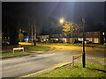
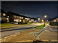
2
Donne Close, Pound Hill, Crawley
One of three dead-ends branching off Chaucer Road in this poetic area.
Image: © Robin Webster
Taken: 3 Feb 2021
0.03 miles
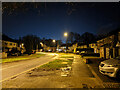
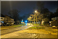
3
Chaucer Road meets St Marys Drive, Pound Hill, Crawley
Image: © Robin Webster
Taken: 3 Feb 2021
0.06 miles
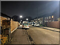
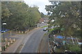
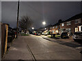
6
St Marys Drive, Pound Hill, Crawley
Curving round to the light controlled single lane under the railway.
Image: © Robin Webster
Taken: 3 Feb 2021
0.07 miles
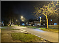
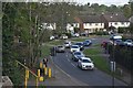
9
Herrick Close, Pound Hill, Crawley
A turning off Chaucer Road. Some of the roads around here are named after greats of literature. I confess I was ignorant of Herrick. It turns out Robert Herrick was a 17th-century English lyric poet.
Image: © Robin Webster
Taken: 3 Mar 2023
0.07 miles
10
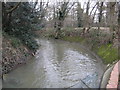
Gatwick Stream in Grattons Park
Gatwick Stream is a tributary of the River Mole. It is seen here in Grattons Park running in a large concrete conduit. Old Victorian era Ordnance Survey maps show that although the general route of the watercourse used to be much the same as it is today, in this reach at least it had a lot more meanders.
Image: © Nigel Cox
Taken: 24 Jan 2010
0.08 miles