IMAGES TAKEN NEAR TO
Brunel Place, CRAWLEY, RH10 1JB
Introduction
This page details the photographs taken nearby to Brunel Place, RH10 1JB by members of the Geograph project.
The Geograph project started in 2005 with the aim of publishing, organising and preserving representative images for every square kilometre of Great Britain, Ireland and the Isle of Man.

There are currently over 7.5m images from over14,400 individuals and you can help contribute to the project by visiting https://www.geograph.org.uk
Image Map
Images are licensed for reuse under creativecommons.org/licenses/by-sa/2.0
Notes
- Clicking on the map will re-center to the selected point.
- The higher the marker number, the further away the image location is from the centre of the postcode.
Image Listing (222 Images Found)
Images are licensed for reuse under creativecommons.org/licenses/by-sa/2.0
Image
Details
Distance
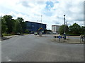
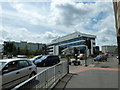
2
Letting agents offices, Brunel Place, 2010
Then 'shortstayuk.com', later 'one rent'.
Image: © Robin Webster
Taken: 13 Jan 2010
0.03 miles
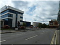
6
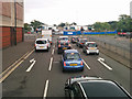
Lights at Station Way - Southgate Avenue junction, Crawley
Viewed from a route 5 bus, which will turn left.
Image: © Robin Webster
Taken: 23 Aug 2017
0.06 miles
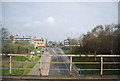
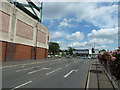
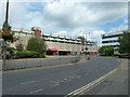
7
Station Way - Southgate Avenue junction, Crawley
Looking from the end of Station Way.
Image: © Robin Webster
Taken: 3 May 2018
0.06 miles
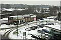
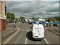
9
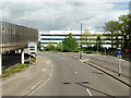
Station Way, Crawley
On the left is part of the access ramp to part of the County Mall car park.
Image: © Robin Webster
Taken: 3 May 2018
0.07 miles