
IMAGES TAKEN NEAR TO
Church Walk, CRAWLEY, RH10 1HH
Introduction
This page details the photographs taken nearby to Church Walk, RH10 1HH by members of the Geograph project.
The Geograph project started in 2005 with the aim of publishing, organising and preserving representative images for every square kilometre of Great Britain, Ireland and the Isle of Man.

There are currently over 7.5m images from over14,400 individuals and you can help contribute to the project by visiting https://www.geograph.org.uk
Image Map
Images are licensed for reuse under creativecommons.org/licenses/by-sa/2.0
Notes
- Clicking on the map will re-center to the selected point.
- The higher the marker number, the further away the image location is from the centre of the postcode.
Image Listing (513 Images Found)
Images are licensed for reuse under creativecommons.org/licenses/by-sa/2.0
Image
Details
Distance
1
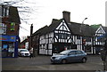
The Ancient Priors
Grade II* listed. http://www.britishlistedbuildings.co.uk/en-363347-the-ancient-priors-minters-restaurant-a-
Image: © N Chadwick
Taken: 26 Nov 2011
0.02 miles
2
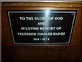
St. John the Baptist, Crawley: memorial (b)
On the hymn book cupboard
Image: © Basher Eyre
Taken: 13 Aug 2011
0.02 miles
4
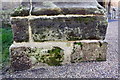
Benchmark on buttress of St John the Baptist Church
Ordnance Survey 1GL bolt benchmark described on the Bench Mark Database at http://www.bench-marks.org.uk/bm65534
Image: © Roger Templeman
Taken: 19 Sep 2015
0.02 miles
5
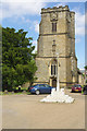
St John's Church, Crawley
This church is the oldest building in Crawley, dating from the 13th century although it has been extensively rebuilt and altered since then. It is now grade II* listed. A war memorial stands in front of the church in this view.
Image: © Stephen McKay
Taken: 20 Jun 2018
0.02 miles
6
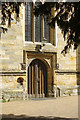
St John's Church, Crawley
This church is the oldest building in Crawley, dating from the 13th century although it has been extensively rebuilt and altered since then. It is now grade II* listed. This view shows the door on the west side beneath the tower.
Image: © Stephen McKay
Taken: 20 Jun 2018
0.02 miles
8
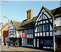
The Ancient Priors in Crawley, West Sussex
This Grade II* listed building is in the High Street.
It is a timber-framed hall-house of circa 1450 with L-wing added circa 1530 and modern brick wing later. It was restored in 1927. It is currently used as an Italian restaurant and an estate agent's business (though they prefer the label, "property consultancy"). It may have been the Pre-Reformation Priest's house.
Information is from http://www.imagesofengland.org.uk/Details/Default.aspx?id=363347&mode=quick
Image]
Image: © Roger D Kidd
Taken: 2 Jan 2012
0.02 miles
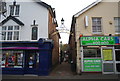
10
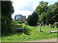
St. John the Baptist, Crawley: churchyard (4)
Image: © Basher Eyre
Taken: 13 Aug 2011
0.02 miles