
IMAGES TAKEN NEAR TO
Farmiloe Close, READING, RG8 8DZ
Introduction
This page details the photographs taken nearby to Farmiloe Close, RG8 8DZ by members of the Geograph project.
The Geograph project started in 2005 with the aim of publishing, organising and preserving representative images for every square kilometre of Great Britain, Ireland and the Isle of Man.

There are currently over 7.5m images from over14,400 individuals and you can help contribute to the project by visiting https://www.geograph.org.uk
Image Map
Images are licensed for reuse under creativecommons.org/licenses/by-sa/2.0
Notes
- Clicking on the map will re-center to the selected point.
- The higher the marker number, the further away the image location is from the centre of the postcode.
Image Listing (47 Images Found)
Images are licensed for reuse under creativecommons.org/licenses/by-sa/2.0
Image
Details
Distance
1

Orange Way after Wiltshire (314)
The walk passes this entrance to Purley Magna.
Image: © Shazz
Taken: 2 Aug 2013
0.03 miles
2

Hazel Road, Purley on Thames
Because there is a gap in the towpath (a marina entrance with no footbridge) the Thames Path is forced to make a detour through residential streets in Purley, before returning to the river at Mapledurham Lock.
Image: © David Purchase
Taken: 18 Apr 2015
0.03 miles


5

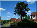
Purley Heights
The area between the railway and the A329 is the "posh" end of Purley. There are many big properties, including an even more exclusive gated estate here at Purley Heights.
Image: © Graham Horn
Taken: 10 Aug 2008
0.06 miles
7
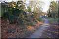
Loop of the old Oxford Road, now footpath
There is an OS benchmark on the wall pier in the left foreground. Ivy and dead leaves removed to reveal the mark Image
Image: © Roger Templeman
Taken: 21 Mar 2012
0.07 miles
8

Benchmark on pier of wall beside the old Oxford Road
Ordnance Survey cut mark benchmark described on the Bench Mark Database at http://www.bench-marks.org.uk/bm42032
Image: © Roger Templeman
Taken: 21 Mar 2012
0.07 miles
9

Duncan Gardens off Hazel Road, Purley Park
Taken from the Thames path.
Image: © Ian S
Taken: 10 Oct 2020
0.07 miles
10

Purley Magna private estate
This gated estate has been developed at Purley Park.
Image: © Rod Allday
Taken: 24 Aug 2008
0.08 miles