
IMAGES TAKEN NEAR TO
Stokes View, READING, RG8 7RP
Introduction
This page details the photographs taken nearby to Stokes View, RG8 7RP by members of the Geograph project.
The Geograph project started in 2005 with the aim of publishing, organising and preserving representative images for every square kilometre of Great Britain, Ireland and the Isle of Man.

There are currently over 7.5m images from over14,400 individuals and you can help contribute to the project by visiting https://www.geograph.org.uk
Image Map
Images are licensed for reuse under creativecommons.org/licenses/by-sa/2.0
Notes
- Clicking on the map will re-center to the selected point.
- The higher the marker number, the further away the image location is from the centre of the postcode.
Image Listing (144 Images Found)
Images are licensed for reuse under creativecommons.org/licenses/by-sa/2.0
Image
Details
Distance
1
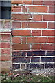
Benchmark on #12 Stokes View
Ordnance Survey cut mark benchmark described on the Bench Mark Database at http://www.bench-marks.org.uk/bm40325
Image: © Roger Templeman
Taken: 27 Nov 2011
0.02 miles
2
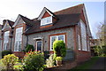
#12 Stokes View
There is an OS benchmark Image on the side of the house at the junction with the fence-topped wall. This block of houses was previously a school
Image: © Roger Templeman
Taken: 27 Nov 2011
0.02 miles
3
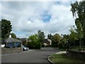
Breedons Hill, Pangbourne: September 2022
Image: © Basher Eyre
Taken: 10 Sep 2022
0.10 miles
4
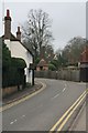
Bend on Pangbourne hill
View up Pangbourne hill towards the bend and what looks like an ice house in a garden.
Image: © Bill Nicholls
Taken: 7 Feb 2010
0.14 miles
5
Bird in the weather vane
Closer view of the building in the church house garden showing the weather vane on the roof.
Image: © Bill Nicholls
Taken: 30 Aug 2009
0.14 miles
6
Building in the garden
This building is in the garden of the old Church house, love to know what it is, ice house?
Image: © Bill Nicholls
Taken: 30 Aug 2009
0.15 miles
7

Green Lane
Green Lane, Pangbourne, which joins with Courtlands Hill.
Image: © Bill Nicholls
Taken: 7 Feb 2010
0.15 miles
8
Pangbourne Hill
The road known as Pangbourne Hill just by the church.
Image: © Bill Nicholls
Taken: 30 Aug 2009
0.15 miles
9

Old lamppost near the river
View of the road to Pangbourne from near Green Lane, the old cast lamppost here looks like it has been forgotten as they usually change them for some hideous new version.
Image: © Bill Nicholls
Taken: 7 Feb 2010
0.15 miles
10

'Little Oaks', Green Lane
There is a black OS flush bracket benchmark Image on the wall at the end of the passageway on the left of the photograph
Image: © Roger Templeman
Taken: 27 Nov 2011
0.16 miles