
IMAGES TAKEN NEAR TO
Woodmans Lane, READING, RG7 3LH
Introduction
This page details the photographs taken nearby to Woodmans Lane, RG7 3LH by members of the Geograph project.
The Geograph project started in 2005 with the aim of publishing, organising and preserving representative images for every square kilometre of Great Britain, Ireland and the Isle of Man.

There are currently over 7.5m images from over14,400 individuals and you can help contribute to the project by visiting https://www.geograph.org.uk
Image Map
Images are licensed for reuse under creativecommons.org/licenses/by-sa/2.0
Notes
- Clicking on the map will re-center to the selected point.
- The higher the marker number, the further away the image location is from the centre of the postcode.
Image Listing (7 Images Found)
Images are licensed for reuse under creativecommons.org/licenses/by-sa/2.0
Image
Details
Distance
1

Abbot's Road, Burghfield Common
Burghfield Common is more of a suburb than a village, even though it's not actually part of a larger town.
Image: © Des Blenkinsopp
Taken: 29 Nov 2014
0.05 miles
2
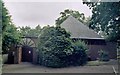
Burghfield Common St Oswald Roman Catholic Church
Erected in 1976.
Image: © Michael FORD
Taken: Unknown
0.09 miles
3

Abbot's Road junction with Hollybush Lane
Image: © Stuart Logan
Taken: 14 Mar 2013
0.17 miles
4
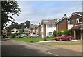
Boldrewood, Burghfield Common
A residential street in this very suburban village.
Image: © Des Blenkinsopp
Taken: 7 Jul 2016
0.20 miles
5

Pastures, Sulhamstead
Looking across a field south of Abbots Farm.
Image: © Andrew Smith
Taken: 6 Mar 2009
0.20 miles
6
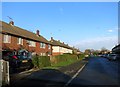
Omer's Rise
At the top of a small valley called Omer's Gully which is behind the houses on the left.
Image: © Des Blenkinsopp
Taken: 29 Nov 2014
0.24 miles
7

Burghfield Common
The Eastern part of this square has some of the village of Burghfield Common. This is a view from Hollybush Lane, looking SW over the fields that dominate the rest of the square.
Image: © Darren Smith
Taken: 11 Jun 2005
0.24 miles