IMAGES TAKEN NEAR TO
Redhatch Drive, READING, RG6 5QN
Introduction
This page details the photographs taken nearby to Redhatch Drive, RG6 5QN by members of the Geograph project.
The Geograph project started in 2005 with the aim of publishing, organising and preserving representative images for every square kilometre of Great Britain, Ireland and the Isle of Man.

There are currently over 7.5m images from over14,400 individuals and you can help contribute to the project by visiting https://www.geograph.org.uk
Image Map
Images are licensed for reuse under creativecommons.org/licenses/by-sa/2.0
Notes
- Clicking on the map will re-center to the selected point.
- The higher the marker number, the further away the image location is from the centre of the postcode.
Image Listing (9 Images Found)
Images are licensed for reuse under creativecommons.org/licenses/by-sa/2.0
Image
Details
Distance
1
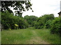
Path from Radstock Lane
This is the start of a path which runs from Radstock Lane to Elm Lane beside a small stream.
Image: © don cload
Taken: 24 Jun 2010
0.12 miles


5

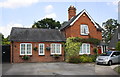
Sibly Hall, Earley
University of Reading halls of residence.
Image: © Andrew Smith
Taken: 3 Dec 2007
0.21 miles
6
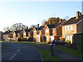
Andrews Road, Maiden Erlegh
Maiden Erlegh (variation spelling of Earley/Erleigh) is a leafy estate of mostly post-war housing but older than neighbouring Lower Earley. The houses here are some of the newer ones.
Image: © Andrew Smith
Taken: 3 Dec 2007
0.23 miles
7
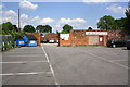
Carpark at entrance to Maiden Erleigh Bowling Club, Beech Lane
Image: © Roger Templeman
Taken: 24 Jul 2014
0.23 miles
8
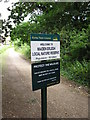
Population 50 billion
I'm not sure who counted this population!
Image: © don cload
Taken: 24 Jun 2010
0.24 miles