
IMAGES TAKEN NEAR TO
The Square, Chalfont Way, READING, RG6 5HJ
Introduction
This page details the photographs taken nearby to The Square, Chalfont Way, RG6 5HJ by members of the Geograph project.
The Geograph project started in 2005 with the aim of publishing, organising and preserving representative images for every square kilometre of Great Britain, Ireland and the Isle of Man.

There are currently over 7.5m images from over14,400 individuals and you can help contribute to the project by visiting https://www.geograph.org.uk
Image Map
Images are licensed for reuse under creativecommons.org/licenses/by-sa/2.0
Notes
- Clicking on the map will re-center to the selected point.
- The higher the marker number, the further away the image location is from the centre of the postcode.
Image Listing (14 Images Found)
Images are licensed for reuse under creativecommons.org/licenses/by-sa/2.0
Image
Details
Distance
2

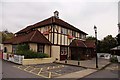
The Way In to Asda
This greenhouse style entrance hall must need quite a lot of cleaning.
Centre shot there's a guy on a cherry picker doing just that.
Image: © Des Blenkinsopp
Taken: 23 Sep 2014
0.11 miles

4

Lower Earley, 1982
At this stage the area was still very much under development. This is the bottom of Beeston Way at its junction with Lower Earley Way. The bridge in the background was built to carry Cutbush Lane over the M4; it was relegated to foot and cycle traffic with the development of Lower Earley Way as a major local distributor road.
Image: © Alan Murray-Rust
Taken: 24 Nov 1982
0.17 miles
5
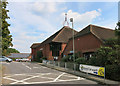
Trinity Church, Lower Earley
This modern church is part of the Asda Superstore complex along with a library and leisure centre. http://www.trinityearley.co.uk/
Image: © Des Blenkinsopp
Taken: 23 Sep 2014
0.18 miles
6

Tiptree Close
Like most streets in Lower Earley, Tiptree Close doesn't go through to anywhere, it's just an access for a dozen or so houses.
The extensive use of external decorative timbering is a feature of this development.
Image: © Des Blenkinsopp
Taken: 13 Nov 2013
0.20 miles
7

Tinsley Close, Reading
When these houses were built in the 1980s, instead of front gardens they were provided with paved areas for the parking of cars.
Image: © Dr Neil Clifton
Taken: 20 Jun 2007
0.22 miles

9

M4 footbridge at Upperwood Farm
This bridge looks too substantial for 'just foot traffic' but then it does take the walker out of suburban Earley into open countryside within a few dozen strides.
Image: © Stuart Logan
Taken: 7 Feb 2013
0.24 miles
