
IMAGES TAKEN NEAR TO
Hilmanton, READING, RG6 4HJ
Introduction
This page details the photographs taken nearby to Hilmanton, RG6 4HJ by members of the Geograph project.
The Geograph project started in 2005 with the aim of publishing, organising and preserving representative images for every square kilometre of Great Britain, Ireland and the Isle of Man.

There are currently over 7.5m images from over14,400 individuals and you can help contribute to the project by visiting https://www.geograph.org.uk
Image Map
Images are licensed for reuse under creativecommons.org/licenses/by-sa/2.0
Notes
- Clicking on the map will re-center to the selected point.
- The higher the marker number, the further away the image location is from the centre of the postcode.
Image Listing (12 Images Found)
Images are licensed for reuse under creativecommons.org/licenses/by-sa/2.0
Image
Details
Distance
1

A playground awaits its users
This playground has been set up at Hillside Primary School during the summer holiday and is all ready for the new term. It includes a castle with drawbridge and a piece of equipment which allows you to play music in various ways.
Image: © HelenK
Taken: 3 Sep 2011
0.09 miles
2

Entering the 20 Zone
Rushey Way coming up to a school entrance.
Image: © Des Blenkinsopp
Taken: 23 Sep 2014
0.10 miles
3

Falcon Avenue
Older suburban housing on the edge of the more recent Lower Earley development.
Image: © Des Blenkinsopp
Taken: 23 Sep 2014
0.11 miles
4
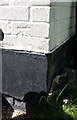
Benchmark on #84 St Barnabas Road
Ordnance Survey cut mark benchmark described on the Bench Mark Database at http://www.bench-marks.org.uk/bm57341
Image: © Roger Templeman
Taken: 12 May 2014
0.12 miles
5
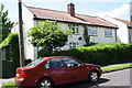
Semi-detached houses on St Barnabas Road
There is an OS benchmark Image on the side of the near house at its front corner, right of a black bin
Image: © Roger Templeman
Taken: 12 May 2014
0.12 miles
6

Tiptree Close
Like most streets in Lower Earley, Tiptree Close doesn't go through to anywhere, it's just an access for a dozen or so houses.
The extensive use of external decorative timbering is a feature of this development.
Image: © Des Blenkinsopp
Taken: 13 Nov 2013
0.15 miles
7
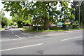
Junction of Shinfield Road and Halls Lane
Image: © Roger Templeman
Taken: 12 May 2014
0.17 miles
8

Ryhill Way, Lower Earley
A leafy area of the large 1980s housing estate.
Image: © Andrew Smith
Taken: 9 Apr 2010
0.18 miles
9

A327 Shinfield Road
Heading towards central Reading.
Image: © Robin Webster
Taken: 22 Aug 2020
0.19 miles
