
IMAGES TAKEN NEAR TO
Pitts Lane, READING, RG6 1BX
Introduction
This page details the photographs taken nearby to Pitts Lane, RG6 1BX by members of the Geograph project.
The Geograph project started in 2005 with the aim of publishing, organising and preserving representative images for every square kilometre of Great Britain, Ireland and the Isle of Man.

There are currently over 7.5m images from over14,400 individuals and you can help contribute to the project by visiting https://www.geograph.org.uk
Image Map
Images are licensed for reuse under creativecommons.org/licenses/by-sa/2.0
Notes
- Clicking on the map will re-center to the selected point.
- The higher the marker number, the further away the image location is from the centre of the postcode.
Image Listing (20 Images Found)
Images are licensed for reuse under creativecommons.org/licenses/by-sa/2.0
Image
Details
Distance
1
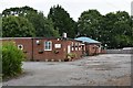
Earley Home Guard Social Club
This private members club was founded in 1944 and sits on Pitt's Lane, Earley.
Image: © Simon Mortimer
Taken: 4 Jul 2020
0.05 miles
2

Pitt's Lane, Earley
Pitt's Lane is the historic lane that linked Sonning and Earley. Earley was part of Sonning parish until 1843. The road was developed for housing from the 1920s onwards, but was previously the boundary between the Bulmershe estate to the south and the Erleigh Court estate to the north
Image: © Simon Mortimer
Taken: 4 Jul 2020
0.05 miles
3

Benchmark on #55 Pitt's Lane
Ordnance Survey cut mark benchmark described on the Bench Mark Database at http://www.bench-marks.org.uk/bm61785
Image: © Roger Templeman
Taken: 3 Nov 2014
0.06 miles
4

#55 Pitt's Lane
There is an OS benchmark Image on the front of the house at the far corner
Image: © Roger Templeman
Taken: 3 Nov 2014
0.06 miles
5

Former Hilltop Christian Centre
This is closed and a notice at the gate says the site has permission for 10 flats.
Image: © Des Blenkinsopp
Taken: 10 Oct 2013
0.09 miles
6

#1 Pitt's Lane
There is an OS benchmark Image on the right hand side of the house, near its front corner, behind the pyracanthus bush
Image: © Roger Templeman
Taken: 3 Nov 2014
0.11 miles
7

Bulmershe Playing fields Woodley
Snow covered fields near Bulmershe School Woodley. A lot more has been enclosed by the school
Image: © norman griffin
Taken: 28 Dec 2000
0.11 miles
8

Benchmark on #1 Pitt's Lane
Ordnance Survey cut mark benchmark described on the Bench Mark Database at http://www.bench-marks.org.uk/bm61909
Image: © Roger Templeman
Taken: 3 Nov 2014
0.11 miles

