
IMAGES TAKEN NEAR TO
Burns Close, READING, RG5 3RP
Introduction
This page details the photographs taken nearby to Burns Close, RG5 3RP by members of the Geograph project.
The Geograph project started in 2005 with the aim of publishing, organising and preserving representative images for every square kilometre of Great Britain, Ireland and the Isle of Man.

There are currently over 7.5m images from over14,400 individuals and you can help contribute to the project by visiting https://www.geograph.org.uk
Image Map
Images are licensed for reuse under creativecommons.org/licenses/by-sa/2.0
Notes
- Clicking on the map will re-center to the selected point.
- The higher the marker number, the further away the image location is from the centre of the postcode.
Image Listing (19 Images Found)
Images are licensed for reuse under creativecommons.org/licenses/by-sa/2.0
Image
Details
Distance
1

Clivedale Road
Some green tiles for a change.
Image: © Des Blenkinsopp
Taken: 7 Feb 2014
0.06 miles
2
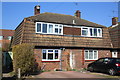
#28 and #26 Knowle Road
There is an OS benchmark Image on the left side, near the front corner, of the left hand house.
Image: © Roger Templeman
Taken: 20 Mar 2015
0.12 miles
3
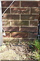
Benchmark on #28 Knowle Road
Ordnance Survey cut mark benchmark described on the Bench Mark Database at http://www.bench-marks.org.uk/bm61776
Image: © Roger Templeman
Taken: 20 Mar 2015
0.12 miles
4
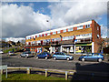
A Row of Shops
Take aways, grocers, undertakers, fishing tackle and something I can't make out in the middle.
Image: © Des Blenkinsopp
Taken: 7 Feb 2014
0.13 miles
5

A329 service road Earley Reading
Snowy view from Wokingham Road about 100 yards from Loddon Bridge
Image: © norman griffin
Taken: 28 Dec 2000
0.16 miles
6

A329 service road Earley Reading
Daffodils along the service road
Image: © norman griffin
Taken: 18 Mar 2003
0.16 miles
7

A329 service road Earley Reading
Good show of daffodils along service road looking towards Loddon Bridge
Image: © norman griffin
Taken: 28 Feb 1997
0.17 miles
8
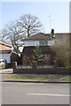
#126 Nightingale Road
The wall fronting the house appears to have been rebuilt since the Ordnance Survey cut a benchmark on it.
Image: © Roger Templeman
Taken: 20 Mar 2015
0.17 miles
9

Reading Earley fields
View across the fields to Wokingham Road before the development of Lower Earley
Image: © norman griffin
Taken: 19 Sep 1976
0.18 miles
10

Stone Crusher in Wokingham Road Earley
One of the largest vehicles to go down the road.
Image: © norman griffin
Taken: 3 Mar 2003
0.18 miles