
IMAGES TAKEN NEAR TO
South Lake Crescent, READING, RG5 3QJ
Introduction
This page details the photographs taken nearby to South Lake Crescent, RG5 3QJ by members of the Geograph project.
The Geograph project started in 2005 with the aim of publishing, organising and preserving representative images for every square kilometre of Great Britain, Ireland and the Isle of Man.

There are currently over 7.5m images from over14,400 individuals and you can help contribute to the project by visiting https://www.geograph.org.uk
Image Map
Images are licensed for reuse under creativecommons.org/licenses/by-sa/2.0
Notes
- Clicking on the map will re-center to the selected point.
- The higher the marker number, the further away the image location is from the centre of the postcode.
Image Listing (6 Images Found)
Images are licensed for reuse under creativecommons.org/licenses/by-sa/2.0
Image
Details
Distance
1
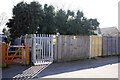
Electricity Substation, The Ridgeway
Image: © Roger Templeman
Taken: 20 Mar 2015
0.11 miles
2
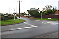
Junction of Loddon Bridge Road and Crockhamwell Road
There are BT manhole covers in the grass verge at the left hand side of the image
Image: © Roger Templeman
Taken: 10 Nov 2014
0.18 miles
3
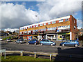
A Row of Shops
Take aways, grocers, undertakers, fishing tackle and something I can't make out in the middle.
Image: © Des Blenkinsopp
Taken: 7 Feb 2014
0.21 miles
4
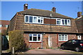
#28 and #26 Knowle Road
There is an OS benchmark Image on the left side, near the front corner, of the left hand house.
Image: © Roger Templeman
Taken: 20 Mar 2015
0.24 miles
5
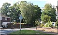
Fairwater Drive, Woodley
The house on the left now has a single storey side extension.
Image: © David Howard
Taken: 23 Sep 2018
0.24 miles
6
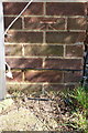
Benchmark on #28 Knowle Road
Ordnance Survey cut mark benchmark described on the Bench Mark Database at http://www.bench-marks.org.uk/bm61776
Image: © Roger Templeman
Taken: 20 Mar 2015
0.25 miles