IMAGES TAKEN NEAR TO
Harding Road, READING, RG5 3ER
Introduction
This page details the photographs taken nearby to Harding Road, RG5 3ER by members of the Geograph project.
The Geograph project started in 2005 with the aim of publishing, organising and preserving representative images for every square kilometre of Great Britain, Ireland and the Isle of Man.

There are currently over 7.5m images from over14,400 individuals and you can help contribute to the project by visiting https://www.geograph.org.uk
Image Map
Images are licensed for reuse under creativecommons.org/licenses/by-sa/2.0
Notes
- Clicking on the map will re-center to the selected point.
- The higher the marker number, the further away the image location is from the centre of the postcode.
Image Listing (14 Images Found)
Images are licensed for reuse under creativecommons.org/licenses/by-sa/2.0
Image
Details
Distance
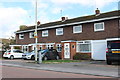
1
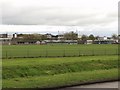
Bulmershe School
The school is seen here viewed from the south west (Woodlands Avenue)
Image: © Mike McMillan
Taken: 18 Apr 2005
0.08 miles
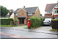
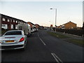
2
Grays Crescent, Woodley
Nice lamp post, shame about the bag.
Image: © Des Blenkinsopp
Taken: 10 Oct 2013
0.09 miles
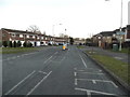
5
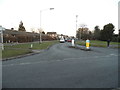
Junction of Wroxham Road with Reading Road
Image: © Roger Templeman
Taken: 3 Nov 2014
0.13 miles
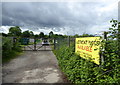
7
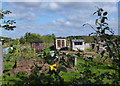
Three Sheds
Woodley allotments. The middle shed looks a bit posh, doesn't it.
Image: © Des Blenkinsopp
Taken: 10 Oct 2013
0.16 miles
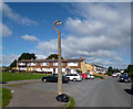
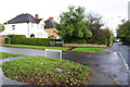
8
Beechwood Avenue at the junction of Howth Drive
Image: © David Howard
Taken: 8 Feb 2015
0.18 miles