
IMAGES TAKEN NEAR TO
Forest Road, BRACKNELL, RG42 7QB
Introduction
This page details the photographs taken nearby to Forest Road, RG42 7QB by members of the Geograph project.
The Geograph project started in 2005 with the aim of publishing, organising and preserving representative images for every square kilometre of Great Britain, Ireland and the Isle of Man.

There are currently over 7.5m images from over14,400 individuals and you can help contribute to the project by visiting https://www.geograph.org.uk
Image Map
Images are licensed for reuse under creativecommons.org/licenses/by-sa/2.0
Notes
- Clicking on the map will re-center to the selected point.
- The higher the marker number, the further away the image location is from the centre of the postcode.
Image Listing (24 Images Found)
Images are licensed for reuse under creativecommons.org/licenses/by-sa/2.0
Image
Details
Distance
1

Carnation Drive at the junction of Forest Road
Image: © David Howard
Taken: 6 Mar 2016
0.08 miles
2

Don Beni, Winkfield Row
Sitting in a road fork, the former White Horse pub is now an Italian restaurant.
Image: © Colin Smith
Taken: 9 May 2010
0.11 miles
3

Road junction, Winkfield Row
The junction between Winkfield Row and Chavey Down Road coming in from the left.
Image: © Alan Hunt
Taken: 13 May 2015
0.11 miles
4

Winkfield Row
The road outside Lambrook Haileybury private school.
Image: © Andrew Smith
Taken: 8 Nov 2005
0.11 miles
5

Pizzeria, Winkfield Row
The Italo Argentinian pizzeria at the junction of Winkfield Row and Chavey Down Road
Image: © Alan Hunt
Taken: 13 May 2015
0.11 miles
6
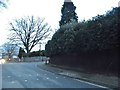
Forest Road at the junction of Chavey Down Road
Image: © David Howard
Taken: 6 Mar 2016
0.12 miles
7
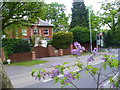
Chavey Down Road, Winkfield Row
This upmarket area near Ascot has many large, gated homes.
Image: © Colin Smith
Taken: 9 May 2010
0.12 miles
8

Cottages, Winkfield Row
Victorian cottages with distinctive diamond patterns in the brickwork. In the foreground is the pavement cafe area of "Don Beni".
Image: © Colin Smith
Taken: 9 May 2010
0.12 miles
9

Winkfield Row
The houses along Winkfield Row near the junction with Chavey Down Road. Winkfield Row is both the name of the road and the settlement.
Image: © Alan Hunt
Taken: 13 May 2015
0.13 miles
10
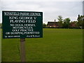
King George V Playing Field
Large triangular recreational area at Winkfield Row. The village primary school is in the distance.
Image: © Colin Smith
Taken: 9 May 2010
0.13 miles