
IMAGES TAKEN NEAR TO
Ferard Corner, BRACKNELL, RG42 6BZ
Introduction
This page details the photographs taken nearby to Ferard Corner, RG42 6BZ by members of the Geograph project.
The Geograph project started in 2005 with the aim of publishing, organising and preserving representative images for every square kilometre of Great Britain, Ireland and the Isle of Man.

There are currently over 7.5m images from over14,400 individuals and you can help contribute to the project by visiting https://www.geograph.org.uk
Image Map
Images are licensed for reuse under creativecommons.org/licenses/by-sa/2.0
Notes
- Clicking on the map will re-center to the selected point.
- The higher the marker number, the further away the image location is from the centre of the postcode.
Image Listing (57 Images Found)
Images are licensed for reuse under creativecommons.org/licenses/by-sa/2.0
Image
Details
Distance
1
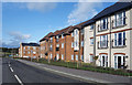
Lawrence Court, Ellison Road
All this area is brand new roads and housing.
Image: © Des Blenkinsopp
Taken: 28 Jan 2020
0.02 miles
2
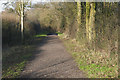
Byway near Bracknell
The byway running from the Forest Road by the Spice Lounge restaurant to Larks Hill Park on the northern outskirt of Bracknell.
Image: © Alan Hunt
Taken: 16 Feb 2016
0.03 miles
3
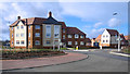
New Housing, Ellison Road
Part of the large scale new development currently taking place on the northern edge of Bracknell.
Image: © Des Blenkinsopp
Taken: 28 Jan 2020
0.03 miles
4
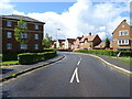
Woodhurst Park
New housing development, Warfield.
Image: © JThomas
Taken: 24 May 2022
0.07 miles
5
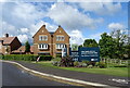
Woodhurst Park
New housing development, Warfield.
Image: © JThomas
Taken: 24 May 2022
0.08 miles
6
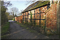
Byway, Newell Green
A converted barn beside the byway from Watersplash Lane to Forest Road.
Image: © Alan Hunt
Taken: 16 Feb 2016
0.09 miles
7
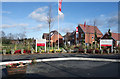
Outside the Sales Office
The flags and perfect gardening that you get at the sales places on new developments. Large new estates are going up all around here.
Image: © Des Blenkinsopp
Taken: 28 Jan 2020
0.10 miles
9
New housing development by Forest Road, West End
These have only recently been completed.
Image: © David Howard
Taken: 23 Sep 2018
0.11 miles
10

The Cut at Bott Bridge
The Cut rises to the north-east of Bracknell, flows south-west here, then west, then north, then east to join the River Thames near Bray. This is the watercourse that has caused flooding in Image in the past.
Image: © Nigel Cox
Taken: 12 Mar 2009
0.12 miles