
IMAGES TAKEN NEAR TO
Stevenson Drive, BRACKNELL, RG42 5TB
Introduction
This page details the photographs taken nearby to Stevenson Drive, RG42 5TB by members of the Geograph project.
The Geograph project started in 2005 with the aim of publishing, organising and preserving representative images for every square kilometre of Great Britain, Ireland and the Isle of Man.

There are currently over 7.5m images from over14,400 individuals and you can help contribute to the project by visiting https://www.geograph.org.uk
Image Map
Images are licensed for reuse under creativecommons.org/licenses/by-sa/2.0
Notes
- Clicking on the map will re-center to the selected point.
- The higher the marker number, the further away the image location is from the centre of the postcode.
Image Listing (19 Images Found)
Images are licensed for reuse under creativecommons.org/licenses/by-sa/2.0
Image
Details
Distance
1
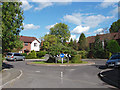
Stevenson Drive
The road through the new estate built to the north of Binfield village.
Image: © Alan Hunt
Taken: 24 Sep 2014
0.04 miles
2
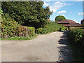
Access road to Recreation ground
The access road off Stevenson's Drive to the car park spaces for the Wick's Green recreation ground in Binfield.
Image: © Alan Hunt
Taken: 24 Sep 2014
0.04 miles
3
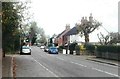
Terrace Road North, Binfield
On the right hand side of the road is the pub sign for the Victoria Arms
Image: © John Baker
Taken: 13 Nov 2005
0.05 miles
4
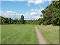
Wick's Green recreation ground
The recreation ground on the northwestern edge of Binfield village.
Image: © Alan Hunt
Taken: 24 Sep 2014
0.06 miles
5
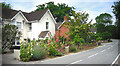
Terrace Road North, Binfield
Houses at the north end of the village, the nearest one with some fine hollyhocks in front.
Image: © Des Blenkinsopp
Taken: 4 Jul 2022
0.12 miles
6
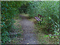
Seat, Wick's Green recreation ground
A seat by the footpath that runs down the east side of the recreation ground. There is a gap in the treeline which allows views across the recreation area from this seat.
Image: © Alan Hunt
Taken: 24 Sep 2014
0.14 miles
7
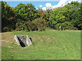
Culvert in Wick's Green recreation ground
A culvert in the recreation area near Wick's Green road with the exit onto the road in the hedge behind.
Image: © Alan Hunt
Taken: 24 Sep 2014
0.15 miles
8
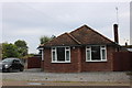
Bungalow on Terrace Road North, Binfield
Image: © David Howard
Taken: 23 Sep 2018
0.16 miles
9

RG42 5PD Goldridge Path & Rymans Path
This is the information board at the start of Goldridge Path and Rymans Path near to RG42 5PD on Wicks Green in Binfield. It highlights the area for the benefit of walkers, including useful information on interesting buildings nearby.
Image: © Roger Crowther
Taken: 25 Aug 2014
0.17 miles
10

Exit from Wick's Green recreation area
The wooden gate at the exit from the Wick's Green recreation area onto Wick's Green road
Image: © Alan Hunt
Taken: 24 Sep 2014
0.17 miles