
IMAGES TAKEN NEAR TO
County Lane, BRACKNELL, RG42 3JQ
Introduction
This page details the photographs taken nearby to County Lane, RG42 3JQ by members of the Geograph project.
The Geograph project started in 2005 with the aim of publishing, organising and preserving representative images for every square kilometre of Great Britain, Ireland and the Isle of Man.

There are currently over 7.5m images from over14,400 individuals and you can help contribute to the project by visiting https://www.geograph.org.uk
Image Map
Images are licensed for reuse under creativecommons.org/licenses/by-sa/2.0
Notes
- Clicking on the map will re-center to the selected point.
- The higher the marker number, the further away the image location is from the centre of the postcode.
Image Listing (23 Images Found)
Images are licensed for reuse under creativecommons.org/licenses/by-sa/2.0
Image
Details
Distance
1
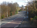
County Lane, Bracknell
Looking east along County Lane from the junction with St Edmund's Way.
Image: © Alan Hunt
Taken: 27 Feb 2015
0.06 miles
2
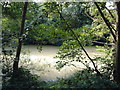
The Hidden Lake
This lake is hidden by trees and covered with duckweed. A nearby road is named "Rachels Lake View", but there is no way they could see it through the trees!
Image: © Liz
Taken: 21 Aug 2005
0.08 miles
3
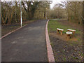
St Edmund's Way, Bracknell
The walkway that follows the course of the Bull Brook through the housing estates of Warfield Park and Bullbrook.
Image: © Alan Hunt
Taken: 27 Feb 2015
0.10 miles
4
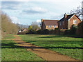
Westmorland park, Bracknell
The southern edge of the park with the housing estate off Westmorland Drive to the south.
Image: © Alan Hunt
Taken: 27 Feb 2015
0.12 miles
5
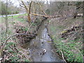
Bull Brook in Bracknell
Viewed looking upstream towards County Lane, a look at the old Ordnance Survey map of 1881 shows that, despite all the house and road building that has gone on in the area since, the brook still flows along the same route as it ever did.
Image: © Nigel Cox
Taken: 12 Mar 2009
0.12 miles
6
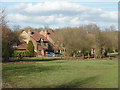
Whitegrove green, Bracknell
The open area to the east of Westmorland Drive with the housing estate off Bedfordshire Down in the background.
Image: © Alan Hunt
Taken: 27 Feb 2015
0.13 miles
7
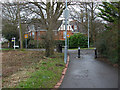
Cycle path, Westmorland Drive
The east end of the cycle path from Jig's Lane South at its junction with Westmorland Drive in the Warfield Park area of Bracknell.
Image: © Alan Hunt
Taken: 24 Feb 2015
0.15 miles
8
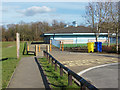
Westmorland park pavilion
The sports pavilion near the car park in Westmorland Park
Image: © Alan Hunt
Taken: 27 Feb 2015
0.15 miles
9
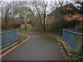
Bridge over the Bull Brook
The bridge over the Bull Brook on the St Edmund's walkway.
Image: © Alan Hunt
Taken: 24 Feb 2015
0.15 miles
10
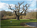
Old oak, Westmorland Park
An old oak near the lake in this eight hectacre park in the Warfield Park area of Bracknell.
Image: © Alan Hunt
Taken: 27 Feb 2015
0.16 miles