
IMAGES TAKEN NEAR TO
Robin Hood Way, WOKINGHAM, RG41 5JN
Introduction
This page details the photographs taken nearby to Robin Hood Way, RG41 5JN by members of the Geograph project.
The Geograph project started in 2005 with the aim of publishing, organising and preserving representative images for every square kilometre of Great Britain, Ireland and the Isle of Man.

There are currently over 7.5m images from over14,400 individuals and you can help contribute to the project by visiting https://www.geograph.org.uk
Image Map
Images are licensed for reuse under creativecommons.org/licenses/by-sa/2.0
Notes
- Clicking on the map will re-center to the selected point.
- The higher the marker number, the further away the image location is from the centre of the postcode.
Image Listing (10 Images Found)
Images are licensed for reuse under creativecommons.org/licenses/by-sa/2.0
Image
Details
Distance
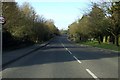
2
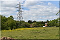
Pasture near Merryhill Green
Once on the banks of Emm Brook, the field is now cut off from the stream by the A329(M) motorway spur.
Image: © Simon Mortimer
Taken: 16 May 2020
0.11 miles
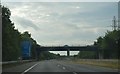
4
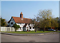
Old House down Primrose Lane
This old place is now surrounded by recent housing not only along Primrose Lane, but also along Bluebell Meadow and Snowdrop Grove, the adjacent roads on this floral sounding estate.
Image: © Des Blenkinsopp
Taken: 14 Mar 2014
0.11 miles
5
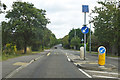
B3030 Robin Hood Lane, Winnersh
Towards Twyford, and ramping up ahead to cross over the A329(M).
Image: © Robin Webster
Taken: 11 Aug 2019
0.12 miles
6
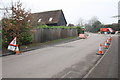
Roadworks on Robin Hood Way at Watmore Lane junction
Image: © Roger Templeman
Taken: 17 Mar 2015
0.13 miles
7
Hard shoulder on A329(M) towards Winnersh
Just past where Emm Brook is crossed by the road
Image: © Clint Mann
Taken: 24 Apr 2015
0.19 miles
8
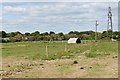
Pony paddocks on Little Hill Road
Looking north across the paddocks towards the houses on Douglas Grange.
Image: © Simon Mortimer
Taken: 16 May 2020
0.21 miles
10
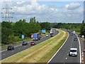
The A329(M), Winnersh
A view towards Reading along the motorway whose spurs link Reading and Bracknell to the M4. Here it is on the boundary between Hurst and Winnersh.
Image: © Andrew Smith
Taken: 4 Jul 2008
0.24 miles