
IMAGES TAKEN NEAR TO
Sturges Road, WOKINGHAM, RG40 2HB
Introduction
This page details the photographs taken nearby to Sturges Road, RG40 2HB by members of the Geograph project.
The Geograph project started in 2005 with the aim of publishing, organising and preserving representative images for every square kilometre of Great Britain, Ireland and the Isle of Man.

There are currently over 7.5m images from over14,400 individuals and you can help contribute to the project by visiting https://www.geograph.org.uk
Image Map
Images are licensed for reuse under creativecommons.org/licenses/by-sa/2.0
Notes
- Clicking on the map will re-center to the selected point.
- The higher the marker number, the further away the image location is from the centre of the postcode.
Image Listing (33 Images Found)
Images are licensed for reuse under creativecommons.org/licenses/by-sa/2.0
Image
Details
Distance
1

Junction of Murdoch Road and Sturges Road
Image: © Roger Templeman
Taken: 17 Mar 2015
0.03 miles
2
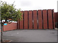
Corpus Christi Church, Wokingham
Erected in 1970 for the Roman Catholics.
Image: © Michael FORD
Taken: Unknown
0.04 miles
3
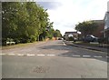
Moles Close, Wokingham
From Easthampstead Road
Image: © David Howard
Taken: 15 Jun 2015
0.09 miles
4
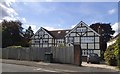
Large house on Murdoch Road, Wokingham
Image: © David Howard
Taken: 15 Jun 2015
0.10 miles
5
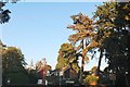
Easthampstead Road, Wokingham
These are similar to the trees in adjoining Bracknell Forest, where they retained as much as they could around the residential areas of the new town.
Image: © David Howard
Taken: 1 Sep 2018
0.13 miles
6
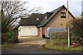
#1 Pages Croft
It appears that the garage present in 1964 when the Ordnance Survey cut a benchmark on it has been replaced by a garage block with rooms above.
Image: © Roger Templeman
Taken: 25 Feb 2015
0.13 miles
7
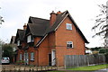
#5 Murdoch Road
There is an OS benchmark Image on the house wall left of the black door on the jut
Image: © Roger Templeman
Taken: 25 Feb 2015
0.14 miles
8
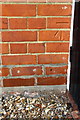
Benchmark on #5 Murdoch Road
Ordnance Survey cut mark benchmark described on the Bench Mark Database at http://www.bench-marks.org.uk/bm34479
Image: © Roger Templeman
Taken: 25 Feb 2015
0.14 miles
9

Wokingham, Wescott Infant School
The photo is of the SE face of the school from Goodchild Road and shows a wall mosaic.
Image: © Roger Templeman
Taken: 22 May 2010
0.17 miles
10

Benchmark on Wescott Infant School
Ordnance Survey cut mark benchmark described on the Bench Mark Database at http://www.bench-marks.org.uk/bm34478
Image: © Roger Templeman
Taken: 17 Mar 2015
0.17 miles