
IMAGES TAKEN NEAR TO
Howard Road, WOKINGHAM, RG40 2BX
Introduction
This page details the photographs taken nearby to Howard Road, RG40 2BX by members of the Geograph project.
The Geograph project started in 2005 with the aim of publishing, organising and preserving representative images for every square kilometre of Great Britain, Ireland and the Isle of Man.

There are currently over 7.5m images from over14,400 individuals and you can help contribute to the project by visiting https://www.geograph.org.uk
Image Map
Images are licensed for reuse under creativecommons.org/licenses/by-sa/2.0
Notes
- Clicking on the map will re-center to the selected point.
- The higher the marker number, the further away the image location is from the centre of the postcode.
Image Listing (102 Images Found)
Images are licensed for reuse under creativecommons.org/licenses/by-sa/2.0
Image
Details
Distance
1
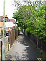
Luckley Path, Wokingham
Straight path leading to the town centre from Howard Road. The old sign can be seen more clearly on http://www.geograph.org.uk/photo/1288604
Image: © don cload
Taken: 5 May 2009
0.04 miles
3
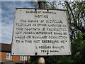
Pre-decimal Sign
A well made sign that has been here at least 38 years! This is at the start of the Luckley Path
Image: © don cload
Taken: 5 May 2009
0.04 miles
4
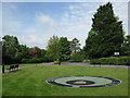
Acorn Sundial, Howard Palmer Gardens
Stand in the centre of the acorn. On a sunny day your shadow will tell the time. Created in 1994.
Image: © don cload
Taken: 5 May 2009
0.05 miles
5
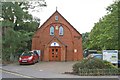
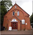
Wokingham - Salvation Army Meeting House
The Meeting House in Sturges Road, Wokingham.
Image: © Brendan and Ruth McCartney
Taken: 18 Oct 2010
0.07 miles
7
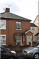
#53 Langborough Road
Ordnance Survey records indicate the existence of a benchmark on the left hand side of the door in 1964. Presumably the mark has been lost by the building of the porch extension.
Image: © Roger Templeman
Taken: 25 Feb 2015
0.07 miles

10
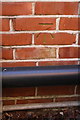
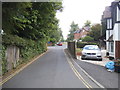
Benchmark on #49 Gipsy Lane
Ordnance Survey cut mark benchmark described on the Bench Mark Database at http://www.bench-marks.org.uk/bm34481
Image: © Roger Templeman
Taken: 6 Mar 2015
0.11 miles