
IMAGES TAKEN NEAR TO
Bird Mews, WOKINGHAM, RG40 1DZ
Introduction
This page details the photographs taken nearby to Bird Mews, RG40 1DZ by members of the Geograph project.
The Geograph project started in 2005 with the aim of publishing, organising and preserving representative images for every square kilometre of Great Britain, Ireland and the Isle of Man.

There are currently over 7.5m images from over14,400 individuals and you can help contribute to the project by visiting https://www.geograph.org.uk
Image Map
Images are licensed for reuse under creativecommons.org/licenses/by-sa/2.0
Notes
- Clicking on the map will re-center to the selected point.
- The higher the marker number, the further away the image location is from the centre of the postcode.
Image Listing (89 Images Found)
Images are licensed for reuse under creativecommons.org/licenses/by-sa/2.0
Image
Details
Distance
1
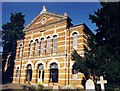
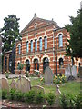
Wokingham Baptist Church
Grade 2 listed building erected in 1861.
Image: © Michael FORD
Taken: Unknown
0.03 miles
3
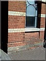
Wokingham, Baptist Church
1964 Ordnance Survey cut mark benchmark on the Baptist Church, Milton Road, levelled at 74.3529m above Newlyn datum. For additional information on this and other nearby benchmarks see Bench Mark Database record http://www.bench-marks.org.uk/bm27563.
Image: © Roger Templeman
Taken: 22 May 2010
0.05 miles
4
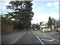
The entrance to Waitrose on Rectory Road
Image: © David Howard
Taken: 15 Jun 2015
0.07 miles
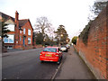
6

Benchmark on Rectory Road wall at Waitrose car park entrance
Ordnance Survey cut mark benchmark described on the Bench Mark Database at http://www.bench-marks.org.uk/bm34472
Image: © Roger Templeman
Taken: 22 May 2010
0.08 miles
7
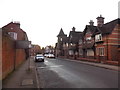
Rectory Road, Wokingham
The eastbound one way section of the A329
Image: © David Howard
Taken: 8 Feb 2015
0.08 miles
8
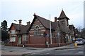
Former police station at Milton Road / Rectory Road junction
There is an OS benchmark Image on the buttress at the near corner of the building
Image: © Roger Templeman
Taken: 25 Feb 2015
0.09 miles
9
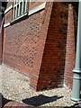
Wokingham, former Police Station
The police station (stone above main entrance inscribed as County Police) has been converted to housing. The photograph shows the buttress on the south angle at the junction of Rectory Road and Milton Road.
Image: © Roger Templeman
Taken: 22 May 2010
0.09 miles
10
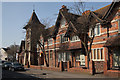
Former police station, Wokingham
Built 1904 to the designs of Berkshire county surveyor Joseph Morris.
Image: © Jim Osley
Taken: 13 Mar 2014
0.09 miles