
IMAGES TAKEN NEAR TO
Sutherland Grove, READING, RG31 7QF
Introduction
This page details the photographs taken nearby to Sutherland Grove, RG31 7QF by members of the Geograph project.
The Geograph project started in 2005 with the aim of publishing, organising and preserving representative images for every square kilometre of Great Britain, Ireland and the Isle of Man.

There are currently over 7.5m images from over14,400 individuals and you can help contribute to the project by visiting https://www.geograph.org.uk
Image Map
Images are licensed for reuse under creativecommons.org/licenses/by-sa/2.0
Notes
- Clicking on the map will re-center to the selected point.
- The higher the marker number, the further away the image location is from the centre of the postcode.
Image Listing (7 Images Found)
Images are licensed for reuse under creativecommons.org/licenses/by-sa/2.0
Image
Details
Distance
1

Ford's Farm
A typical estate road in the 1970s housing development south of Bath Road.
Image: © Graham Horn
Taken: 2 Mar 2009
0.01 miles
2

Ford's Farm
It is surprisingly not named on the OS maps, but this estate to the south of Bath Road is known as Ford's Farm after the farmland that it was built on in the 1970s. For some reason that is obscure now we used to rearrange the letters and call it Framsdorf, but it doesn't even have a German feel. This is Carter's Rise, the main road and bus route through the estate.
Image: © Graham Horn
Taken: 2 Mar 2009
0.09 miles


6
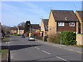
Calcot Place Drive, Holybrook
One of the main roads on the Ford's Farm estate.
Image: © Andrew Smith
Taken: 16 Mar 2010
0.24 miles
7
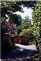
Reading, Calcot
Mill Lane, close to Calcot Mill
Image: © Rosalind Mitchell
Taken: Unknown
0.25 miles