
IMAGES TAKEN NEAR TO
Post Horn Place, READING, RG31 7QE
Introduction
This page details the photographs taken nearby to Post Horn Place, RG31 7QE by members of the Geograph project.
The Geograph project started in 2005 with the aim of publishing, organising and preserving representative images for every square kilometre of Great Britain, Ireland and the Isle of Man.

There are currently over 7.5m images from over14,400 individuals and you can help contribute to the project by visiting https://www.geograph.org.uk
Image Map
Images are licensed for reuse under creativecommons.org/licenses/by-sa/2.0
Notes
- Clicking on the map will re-center to the selected point.
- The higher the marker number, the further away the image location is from the centre of the postcode.
Image Listing (22 Images Found)
Images are licensed for reuse under creativecommons.org/licenses/by-sa/2.0
Image
Details
Distance
1
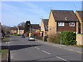
Calcot Place Drive, Holybrook
One of the main roads on the Ford's Farm estate.
Image: © Andrew Smith
Taken: 16 Mar 2010
0.02 miles
2
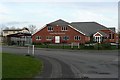
Pub and church, Ford's Farm
The Kennet Valley Free church is a relatively recent building, it was not there when I was living in Ford's Farm from 1991 to 1996. The pub behind is now called the Happy Pea! I cannot remember its previous name, but it used to be an uninspired estate pub that I went into once.
Image: © Graham Horn
Taken: 2 Mar 2009
0.07 miles
3
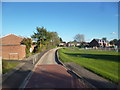
Extreme Bus Lane 2
The start of the fortified bus route featured in Image
Image: © Des Blenkinsopp
Taken: 4 Nov 2013
0.07 miles
4
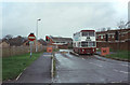
Bus Link, Underwood Road, 1982
It was a condition of the development of the Fords Farm and Calcot housing estates that a link with the existing bus route 25 should be provided, but that other motor traffic should be excluded to prevent rat-running through residential areas. This installation with rising barriers may well be unique in the UK.
This is one of a series of views featuring buses in the 60s, 70s, and 80s. http://www.geograph.org.uk/search.php?i=2114547&displayclass=slide
Image: © Alan Murray-Rust
Taken: 23 Nov 1982
0.11 miles
5
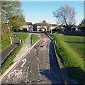
Extreme Bus Lane
Reading buses are determined to keep other traffic off their bus lane.
This friendly device is called a sump breaker according to the warning notices, and presumably trashes your car if you are so naughty as to stray onto bus territory.
Even passing bicycles are aimed well clear of it.
Image: © Des Blenkinsopp
Taken: 4 Nov 2013
0.11 miles
6
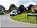
Looking west on Underwood Road from the junction with Holmwood Avenue
Image: © Shazz
Taken: 9 Aug 2014
0.14 miles
8
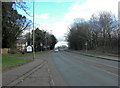
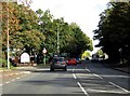
The A4 enters Reading
Because of its ultimate destination to the west, the A4 is also called the Bath Road especially when it enters urban areas.
Image: © Stuart Logan
Taken: 24 Feb 2012
0.19 miles
9
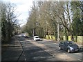
The Bath Road fringed by trees, Calcot, Reading
Deceptive: it's not open country yet. There's a golf course, Calcott Park, on the right and residential estates on the left.
Image: © Robin Stott
Taken: 7 Mar 2015
0.19 miles
10
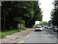
Reading : Bath Road A4
Heading into Reading on the A4.
Image: © Lewis Clarke
Taken: 18 Jul 2019
0.19 miles