
IMAGES TAKEN NEAR TO
Rosemead Avenue, READING, RG31 6FJ
Introduction
This page details the photographs taken nearby to Rosemead Avenue, RG31 6FJ by members of the Geograph project.
The Geograph project started in 2005 with the aim of publishing, organising and preserving representative images for every square kilometre of Great Britain, Ireland and the Isle of Man.

There are currently over 7.5m images from over14,400 individuals and you can help contribute to the project by visiting https://www.geograph.org.uk
Image Map
Images are licensed for reuse under creativecommons.org/licenses/by-sa/2.0
Notes
- Clicking on the map will re-center to the selected point.
- The higher the marker number, the further away the image location is from the centre of the postcode.
Image Listing (10 Images Found)
Images are licensed for reuse under creativecommons.org/licenses/by-sa/2.0
Image
Details
Distance
1
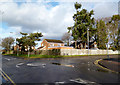
Knowsley Road
At the junction with Long Lane. This is the western edge of the Reading conurbation.
Image: © Des Blenkinsopp
Taken: 28 Jan 2014
0.07 miles
2

Benchmark on wall at entrance to #133A Long Lane
Ordnance Survey cut mark benchmark described on the Bench Mark Database at http://www.bench-marks.org.uk/bm42035
Image: © Roger Templeman
Taken: 21 Mar 2012
0.08 miles
3

Entrance to 'Rose Way', Long Lane
There is an OS benchmark Image on the wall on the right hand side of the drive behind the shrubs.
Image: © Roger Templeman
Taken: 21 Mar 2012
0.08 miles
4

#99 Long Lane
In 1951 the Ordnance Survey verified a cut mark benchmark at 82.41m above Newlyn datum on the side of the house. It may still be there hidden behind an oil tank behind the bush.
Image: © Roger Templeman
Taken: 21 Mar 2012
0.10 miles
5

Long Lane
Pretty much the western edge of suburban Reading, this is a main through road linking a lot of short residential streets.
Image: © Des Blenkinsopp
Taken: 28 Jan 2014
0.11 miles
6
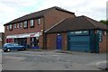
Knowsley Road shops
In the heart of 1980s suburbia, a Tesco Express and an estate agents. One wonders why it needs roller shuttering.
Image: © Graham Horn
Taken: 20 Jul 2008
0.14 miles
7

#1 White Lodge Close
The house named 'BAHIA' is at the junction of Long Lane and White Lodge Close. There is an OS benchmark Image on the wall pier to the left of the road name sign.
Image: © Roger Templeman
Taken: 21 Mar 2012
0.15 miles
8
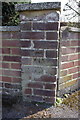
Benchmark on wall outside #1 White Lodge Close
Ordnance Survey cut mark benchmark described on the Bench Mark Database at http://www.bench-marks.org.uk/bm42034
Image: © Roger Templeman
Taken: 21 Mar 2012
0.16 miles

10

Knowsley Road, Tilehurst
Typical west Reading suburbia. The road drops down the hill to the suburban village of Purley.
Image: © Andrew Smith
Taken: 17 Apr 2008
0.20 miles