
IMAGES TAKEN NEAR TO
Pennine Close, READING, RG31 5QD
Introduction
This page details the photographs taken nearby to Pennine Close, RG31 5QD by members of the Geograph project.
The Geograph project started in 2005 with the aim of publishing, organising and preserving representative images for every square kilometre of Great Britain, Ireland and the Isle of Man.

There are currently over 7.5m images from over14,400 individuals and you can help contribute to the project by visiting https://www.geograph.org.uk
Image Map
Images are licensed for reuse under creativecommons.org/licenses/by-sa/2.0
Notes
- Clicking on the map will re-center to the selected point.
- The higher the marker number, the further away the image location is from the centre of the postcode.
Image Listing (12 Images Found)
Images are licensed for reuse under creativecommons.org/licenses/by-sa/2.0
Image
Details
Distance
1
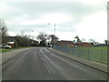
Littleheath Road beside the Recreation Ground
Image: © Stuart Logan
Taken: 24 Feb 2012
0.08 miles
3
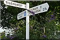
At the end of Little Heath Road
The signpost should give us a pretty good clue where we are. I like the contrast with the buddleia, but it is rather too dark.
Image: © Graham Horn
Taken: 13 Jul 2008
0.10 miles
4
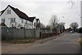
Turnhams House, Pincents Lane
The house is where Pincents Lane and Little Heath Road meet at the junction with City Road. In 1972 the Ordnance Survey verified a cut mark benchmark levelled at 103.44m above Newlyn Datum on the near end of the roadside wall. However, the wall appears to have been shortened with a new end pier constructed. A footpath to Nunhide Lane goes left at this point.
Image: © Roger Templeman
Taken: 16 Mar 2012
0.11 miles
5
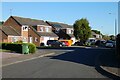
Farm Drive, Tilehurst
Houses at the western edge of Reading's built-up area.
Image: © Andrew Smith
Taken: 14 May 2020
0.14 miles
6
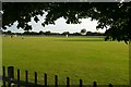
Little Heath Road playing fields
The playing fields belonging to Tilehurst scouts, in the late evening sun. Above the tree in the middle distance you can just make out a hot air balloon. It landed on these fields about half an hour later, by which time I was elsewhere. Timing.
Image: © Graham Horn
Taken: 13 Jul 2008
0.15 miles
8
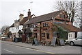
Fox & Hounds pub, City Road
There is probably an Ordnance Survey cut mark benchmark on the near corner of the pub, but hidden behind a flower tub and ivy. The mark was levelled by the OS at 96.94m above Newlyn Datum and verified in 1972.
Image: © Roger Templeman
Taken: 16 Mar 2012
0.18 miles

10
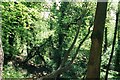
Turnham's Farm
Woodland on the city's edge. This wood belongs to West Berkshire rather than Reading, and is less managed and more naturalistic. The downside of this is that it is more cratered, the tracks are narrower and rougher, and there is a risk of a twisted ankle if you wander in there in sandals with a Nikon slung round your neck!
Image: © Rosalind Mitchell
Taken: 13 May 2005
0.22 miles