
IMAGES TAKEN NEAR TO
Chapel Hill, READING, RG31 5DG
Introduction
This page details the photographs taken nearby to Chapel Hill, RG31 5DG by members of the Geograph project.
The Geograph project started in 2005 with the aim of publishing, organising and preserving representative images for every square kilometre of Great Britain, Ireland and the Isle of Man.

There are currently over 7.5m images from over14,400 individuals and you can help contribute to the project by visiting https://www.geograph.org.uk
Image Map
Images are licensed for reuse under creativecommons.org/licenses/by-sa/2.0
Notes
- Clicking on the map will re-center to the selected point.
- The higher the marker number, the further away the image location is from the centre of the postcode.
Image Listing (21 Images Found)
Images are licensed for reuse under creativecommons.org/licenses/by-sa/2.0
Image
Details
Distance
1
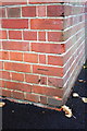
Benchmark on Park Lane Primary School
Ordnance Survey cut mark benchmark described on the Bench Mark Database at http://www.bench-marks.org.uk/bm40380
Image: © Roger Templeman
Taken: 4 Nov 2011
0.10 miles
2
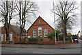
Park Lane Primary School, School Road
The school is at the junction of Park Lane/School Road and Downing Road, with an OS benchmark Image on the right corner of the building on the right.
Image: © Roger Templeman
Taken: 4 Nov 2011
0.10 miles
3
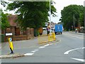
Looking along School Road
The school is on the left of the picture.
Image: © Shazz
Taken: 2 Aug 2013
0.11 miles
4

Tilehurst
After the relentless suburbia it comes as a bit of a surprise that there is a subsidiary commercial centre. This is the original village - possibly a small town - of Tilehurst, long since swallowed by the mighty Reading.
Image: © Rosalind Mitchell
Taken: 12 May 2005
0.12 miles
5

Tilehurst "Village"
Though it was a small town, and is now quite a significant commercial centre, Tilehurst likes to stress its 'villageness' - hence the Village Coffee Bar.
Image: © Rosalind Mitchell
Taken: 12 May 2005
0.12 miles
6
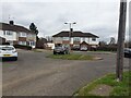
Beverley Road roundabout
A roundabout at the end of Beverley Road. There is a footpath to the right that leads to Elmstone Drive, Ashton Close, Oak View, Chapel Hill and Lambourne Close.
Image: © Oscar Taylor
Taken: 3 Mar 2023
0.13 miles
7
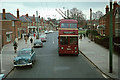
British Trolleybuses - Reading
A view at Tilehurst Triangle from a trolleybus bound for the town centre. Tilehurst is an old established village which has been absorbed into Reading but is still an important local commercial centre. The view has changed little over the years.
For a slide show of British Trolleybuses in the late 60s http://www.geograph.org.uk/search.php?i=1773236&displayclass=slide
Image: © Alan Murray-Rust
Taken: 30 Mar 1966
0.16 miles
8
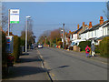
Westwood Road, Tilehurst
The number 33 bus route makes its way away from Tilehurst Triangle.
Image: © Andrew Smith
Taken: 2 Mar 2011
0.16 miles

10
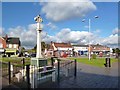
Tilehurst War Memorial
On The Triangle in the centre of Tilehurst.
Image: © Des Blenkinsopp
Taken: 4 Nov 2013
0.18 miles