
IMAGES TAKEN NEAR TO
Alford Close, READING, RG30 4TB
Introduction
This page details the photographs taken nearby to Alford Close, RG30 4TB by members of the Geograph project.
The Geograph project started in 2005 with the aim of publishing, organising and preserving representative images for every square kilometre of Great Britain, Ireland and the Isle of Man.

There are currently over 7.5m images from over14,400 individuals and you can help contribute to the project by visiting https://www.geograph.org.uk
Image Map
Images are licensed for reuse under creativecommons.org/licenses/by-sa/2.0
Notes
- Clicking on the map will re-center to the selected point.
- The higher the marker number, the further away the image location is from the centre of the postcode.
Image Listing (23 Images Found)
Images are licensed for reuse under creativecommons.org/licenses/by-sa/2.0
Image
Details
Distance
1

Gratwicke Road, Reading
Semi-detached houses close to the commercial centre of Tilehurst.
Image: © Andrew Smith
Taken: 11 Apr 2019
0.09 miles
2
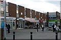
Tilehurst Triangle
There is a thriving shopping parade at Tilehurst Triangle, the centre of what are now extensive suburbs to the west of Reading, but which still calls itself a village.
Image: © Graham Horn
Taken: 2 Mar 2009
0.11 miles
3

Benchmark on #33 St Michael's Road
Ordnance Survey cut mark benchmark described on the Bench Mark Database at http://www.bench-marks.org.uk/bm42145
Image: © Roger Templeman
Taken: 21 Mar 2012
0.12 miles
4

#33 St Michael's Road
There is an OS benchmark Image on the side of the house
Image: © Roger Templeman
Taken: 21 Mar 2012
0.12 miles
5

Benchmark on #58 St Michael's Road
Ordnance Survey cut mark benchmark described on the Bench Mark Database at http://www.bench-marks.org.uk/bm41720
Image: © Roger Templeman
Taken: 21 Mar 2012
0.12 miles
6

#58 St Michael's Road
There is an OS benchmark Image on the front of the house behind the brick wall
Image: © Roger Templeman
Taken: 21 Mar 2012
0.12 miles
7
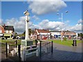
Tilehurst War Memorial
On The Triangle in the centre of Tilehurst.
Image: © Des Blenkinsopp
Taken: 4 Nov 2013
0.13 miles
8
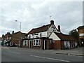
The Plough, School Road: September 2022
Image: © Basher Eyre
Taken: 10 Sep 2022
0.13 miles
9
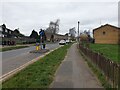
Traffic calming on Corwen Road
Looking north west on Corwen Road past a traffic calming measure: there are several on this road to prevent it being used as a shortcut. They are often flattened by drivers not paying attention and driving straight through them.
Image: © Oscar Taylor
Taken: 3 Mar 2023
0.13 miles
10
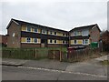
102-104 Corwen Road
A block of flats on Corwen Road, viewed from Ogmore Close. They were built in the 1970s.
Image: © Oscar Taylor
Taken: 3 Mar 2023
0.14 miles