IMAGES TAKEN NEAR TO
Portman Road, READING, RG30 1JG
Introduction
This page details the photographs taken nearby to Portman Road, RG30 1JG by members of the Geograph project.
The Geograph project started in 2005 with the aim of publishing, organising and preserving representative images for every square kilometre of Great Britain, Ireland and the Isle of Man.

There are currently over 7.5m images from over14,400 individuals and you can help contribute to the project by visiting https://www.geograph.org.uk
Image Map
Images are licensed for reuse under creativecommons.org/licenses/by-sa/2.0
Notes
- Clicking on the map will re-center to the selected point.
- The higher the marker number, the further away the image location is from the centre of the postcode.
Image Listing (64 Images Found)
Images are licensed for reuse under creativecommons.org/licenses/by-sa/2.0
Image
Details
Distance


3

Portman Road going west near Little Johns Lane
Image: © Shazz
Taken: 7 Aug 2013
0.05 miles

5

Another Section
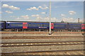
Another section of the construction which looks like it is nearly complete at Reading
Image: © Bill Nicholls
Taken: 20 Jun 2014
0.06 miles


8

Portman Road south of junction with Littlejohn's Lane
The lane, which is on the left, crosses under the railway to reach a farm of the same name.
Image: © Stuart Logan
Taken: 17 Sep 2013
0.09 miles
9

Gordon Place
The north end of Gordon Place, and into Fulmead Road, consists of later terraced housing, probably 1970s.
Image: © Graham Horn
Taken: 14 Nov 2008
0.09 miles