
IMAGES TAKEN NEAR TO
Emblen Crescent, READING, RG2 9PA
Introduction
This page details the photographs taken nearby to Emblen Crescent, RG2 9PA by members of the Geograph project.
The Geograph project started in 2005 with the aim of publishing, organising and preserving representative images for every square kilometre of Great Britain, Ireland and the Isle of Man.

There are currently over 7.5m images from over14,400 individuals and you can help contribute to the project by visiting https://www.geograph.org.uk
Image Map
Images are licensed for reuse under creativecommons.org/licenses/by-sa/2.0
Notes
- Clicking on the map will re-center to the selected point.
- The higher the marker number, the further away the image location is from the centre of the postcode.
Image Listing (53 Images Found)
Images are licensed for reuse under creativecommons.org/licenses/by-sa/2.0
Image
Details
Distance
1

Coombes School
This is one of the main buildings of the Coombes CE Primary School in Arborfield, formed in the last year from a junion school and an infants school on the same site. This building dates from the 1870's.
Image: © Rob Wilcox
Taken: 23 Dec 2008
0.03 miles
2

Small Footpath Opposite School
This narrow footpath opposite the school in Arborfield leads from the school to a cul-de-sac called Emblem Way. It's often used by children and parents as a cut through to where they have parked their cars.
Image: © Rob Wilcox
Taken: 23 Dec 2008
0.05 miles
3

Benchmark on Coombes School
Ordnance Survey cut mark benchmark described on the Bench Mark Database at http://www.bench-marks.org.uk/bm39514
Image: © Roger Templeman
Taken: 15 Jul 2014
0.08 miles
5

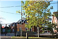
Coombes Primary School
There is an OS benchmark Image on the near corner of the school just through the railing gate
Image: © Roger Templeman
Taken: 15 Jul 2014
0.08 miles
6

Link Way
This is the entrance to Link Way from School Road in Arborfield. Part of the school is directly behind me when taking this photograph on a rather grey afternoon.
Image: © Rob Wilcox
Taken: 23 Dec 2008
0.08 miles
7

Anderson Crescent, Arborfield
The crescent is arranged around a central green.
Image: © Andrew Smith
Taken: 24 Apr 2009
0.09 miles
8

Bend on Link Way
I was hoping to find a footpath on the right but looking at the map more closely the path seems to stop in a dead end way and not join the road.
Image: © Shazz
Taken: 27 Feb 2015
0.09 miles
9

Emblem Crescent
Emblem Crescent is a small cul-de-sac off Link Way in Arborfield. Often used by parents dropping off children at the nearby school, there is a cut through at the opposite end of the road. This view is looking into Emblem Crescent from the garages on Link Way.
Image: © Rob Wilcox
Taken: 23 Dec 2008
0.10 miles
10
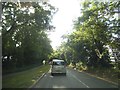
School Lane entering Arborfield
Since they narrowed the road to a single lane this is the inevitable result, all day every day. It probably takes about five minutes out of each person's life, that adds up to a lot just in a single week. They have to take turns passing and goes on for half a mile or so.
Image: © David Howard
Taken: 15 Jun 2015
0.11 miles