
IMAGES TAKEN NEAR TO
Ducketts Mead, READING, RG2 9GY
Introduction
This page details the photographs taken nearby to Ducketts Mead, RG2 9GY by members of the Geograph project.
The Geograph project started in 2005 with the aim of publishing, organising and preserving representative images for every square kilometre of Great Britain, Ireland and the Isle of Man.

There are currently over 7.5m images from over14,400 individuals and you can help contribute to the project by visiting https://www.geograph.org.uk
Image Map
Images are licensed for reuse under creativecommons.org/licenses/by-sa/2.0
Notes
- Clicking on the map will re-center to the selected point.
- The higher the marker number, the further away the image location is from the centre of the postcode.
Image Listing (11 Images Found)
Images are licensed for reuse under creativecommons.org/licenses/by-sa/2.0
Image
Details
Distance
1

Greenwich Road
A new development of assorted blocks on the edge of town.
Image: © Des Blenkinsopp
Taken: 13 Nov 2013
0.13 miles
2

Back of Wakefield Cottage
Magnificent and spacious home of historical interest having been the former headquarters of the RAF flying training command 1940-1968. Now Grade II listed.
The Lodge has been beautifully restored to former glory after years of neglect following its closure after being a major part of the RAF's history. Originally built as a substantial family home the property was adopted by the RAF in 1940 and used throughout World War II as a command centre for RAF flying training, known as RAF Shinfield Park. After its closure on 1968 the property eventually fell into disrepair until refurbished
Image: © Roger Templeman
Taken: 12 May 2014
0.16 miles
3

Borough of Wokingham : M4 Motorway
The M4 Motorway between Junction 11 and Junction 10 (Winnersh Interchange).
Image: © Lewis Clarke
Taken: 23 Mar 2018
0.17 miles
4

GR letter box pillar with benchmark, Shinfield Road
Ordnance Survey cut mark benchmark described on the Bench Mark Database at http://www.bench-marks.org.uk/bm57340
Image: © Roger Templeman
Taken: 12 May 2014
0.17 miles
5

'Leighton', Shinfeld Road
There is an OS benchmark Image on the brick pillar of the GR letterbox to the right of the house entrance
Image: © Roger Templeman
Taken: 12 May 2014
0.17 miles
6
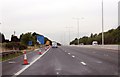
M4 westbound, get in lane for A33
Junction 11 is ahead.
At marker 63.5
Image: © Julian P Guffogg
Taken: 7 Aug 2013
0.17 miles
7

Roundabout on Reading Road, Shinfield
At the B3270 junction just beyond the M4 crossing.
Image: © David Howard
Taken: 6 Mar 2016
0.19 miles
8

Lower Earley
The western, up-market end of Reading's vast expansion in the 1990s, close to Shinfield and bordering on the M4 whose hum is ever present hereabouts. Here are double garages and faux half-timbering.
Image: © Rosalind Mitchell
Taken: 28 Apr 2005
0.19 miles
9

Reading : M4 Motorway
Passing under the bridge on the M4 Motorway.
Image: © Lewis Clarke
Taken: 20 Oct 2022
0.21 miles
10

The old A327 bridge and the new one crossing the M4
Image: © Rob Purvis
Taken: 13 Aug 2021
0.23 miles