
IMAGES TAKEN NEAR TO
Dearlove Place, READING, RG2 9FZ
Introduction
This page details the photographs taken nearby to Dearlove Place, RG2 9FZ by members of the Geograph project.
The Geograph project started in 2005 with the aim of publishing, organising and preserving representative images for every square kilometre of Great Britain, Ireland and the Isle of Man.

There are currently over 7.5m images from over14,400 individuals and you can help contribute to the project by visiting https://www.geograph.org.uk
Image Map
Images are licensed for reuse under creativecommons.org/licenses/by-sa/2.0
Notes
- Clicking on the map will re-center to the selected point.
- The higher the marker number, the further away the image location is from the centre of the postcode.
Image Listing (12 Images Found)
Images are licensed for reuse under creativecommons.org/licenses/by-sa/2.0
Image
Details
Distance
1
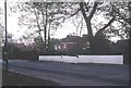
Shinfield
An up-market 1920s suburb of Reading, strung out along the A327 Aldershot road.
Image: © Rosalind Mitchell
Taken: 28 Apr 2005
0.08 miles
3
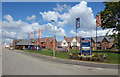
Reading is Spreading
New houses in Shinfield. The developers have crossed the motorway. Nothing to stop them now.
Image: © Des Blenkinsopp
Taken: 26 Apr 2017
0.14 miles
4
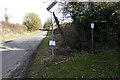
Looking east on Cutbush Lane from footpath junction
Image: © Shazz
Taken: 27 Feb 2015
0.16 miles
5
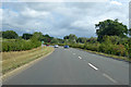
A327 towards Reading
Bypassing Shinfield since 2018.
Image: © Robin Webster
Taken: 22 Aug 2020
0.19 miles
6
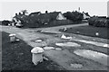
Oatlands Road, Shinfield
For some reason the southern section of Oatlands Road hasn't been surfaced and is in this rustic looking state.
The map specifically marks it as a footpath although apart from the lack of tarmac it's a normal residential road, like Wychelm Road opposite where the surface just stops at the junction.
Image: © Des Blenkinsopp
Taken: 12 Nov 2013
0.19 miles
7
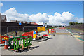
More Roads, More Houses
It's what fields are for......
Image: © Des Blenkinsopp
Taken: 26 Apr 2017
0.20 miles

10

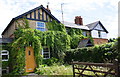
Benchmark on #20 Hollow Lane
Ordnance Survey cut mark benchmark described on the Bench Mark Database at http://www.bench-marks.org.uk/bm58650
Image: © Roger Templeman
Taken: 10 Jul 2014
0.25 miles