IMAGES TAKEN NEAR TO
Blounce, HOOK, RG29 1RX

Introduction

This page details the photographs taken nearby to Blounce, RG29 1RX by members of the Geograph project.

The Geograph project started in 2005 with the aim of publishing, organising and preserving representative images for every square kilometre of Great Britain, Ireland and the Isle of Man.

There are currently over 7.5m images from over14,400 individuals and you can help contribute to the project by visiting https://www.geograph.org.uk

Image Map


Images are licensed for reuse under creativecommons.org/licenses/by-sa/2.0
Notes
  • Clicking on the map will re-center to the selected point.
  • The higher the marker number, the further away the image location is from the centre of the postcode.

Image Listing (9 Images Found)

Images are licensed for reuse under creativecommons.org/licenses/by-sa/2.0
Image
Details
Distance
1
Old Milestone by the B3349, Blounce, South Warnborough Parish
Carved stone post by the B3349, in parish of SOUTH WARNBOROUGH (HART District), Blounce, on grass verge between road and ditch, on West side of road. Hook pillar, erected by the Basingstoke, Hartfordbridge & Blackwater (and Odiham) turnpike trust in the 19th century. Inscription reads:- ODIHAM 4 ALTON 4 MILES Carved benchmark. Milestone Society National ID: HA_ODAL04.
Image: © K Lawrence Taken: 21 Dec 2002
0.06 miles
2
Milestone at Blounce, midway between Alton and Odiham
A milestone on the B3349, once the rather grander-sounding A32, in the hamlet of Blounce. See also Image
Image: © Hugh Chevallier Taken: 16 May 2006
0.08 miles
3
Blounce
Looking down slightly towards the hamlet of Blounce (midway between Alton and Odiham on the B3349) from the public footpath in the south-east corner of the grid square. The B-road is in the trees.
Image: © Hugh Chevallier Taken: 16 May 2006
0.16 miles
4
Looking southwards on Westers Lane
Westers Lane is a byway.
Image: © Shazz Taken: 23 Aug 2014
0.21 miles
5
Junction of public rights of way at Humbly Grove
The camera is in an unnamed byway. Going off to the left is the public road which starts here. A picture from 2006 is at http://www.geograph.org.uk/photo/168382.
Image: © Shazz Taken: 23 Aug 2014
0.22 miles
6
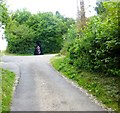
Disappearing motorcyclist at Humbly Grove
Half a dozen or so motorcyclists came out from the byway on the left (Westers Lane) and this is the last one disappearing into the byway known as Bayman's Lane.
Image: © Shazz Taken: 23 Aug 2014
0.22 miles
7
Looking north on Bayman's Lane
Bayman's Lane is a byway open to all traffic. Ahead is a crossing of byways and roads.
Image: © Shazz Taken: 31 Aug 2014
0.22 miles
8
Entering Blounce, B3349
Image: © N Chadwick Taken: 9 Jul 2016
0.23 miles
9
Spring light on Bayman's Lane
The young beech leaves shimmer in the April sun.
Image: © Hugh Chevallier Taken: 17 Apr 2007
0.24 miles