
IMAGES TAKEN NEAR TO
Alton Road, HOOK, RG29 1PJ
Introduction
This page details the photographs taken nearby to Alton Road, RG29 1PJ by members of the Geograph project.
The Geograph project started in 2005 with the aim of publishing, organising and preserving representative images for every square kilometre of Great Britain, Ireland and the Isle of Man.

There are currently over 7.5m images from over14,400 individuals and you can help contribute to the project by visiting https://www.geograph.org.uk
Image Map
Images are licensed for reuse under creativecommons.org/licenses/by-sa/2.0
Notes
- Clicking on the map will re-center to the selected point.
- The higher the marker number, the further away the image location is from the centre of the postcode.
Image Listing (157 Images Found)
Images are licensed for reuse under creativecommons.org/licenses/by-sa/2.0
Image
Details
Distance

2
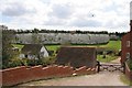
Odiham
This curious chalk "cliff" maybe seen just west of the town beside the B3349 road at Chalk Pit Farm.
Image: © Brendan and Ruth McCartney
Taken: 18 Apr 2005
0.05 miles
3
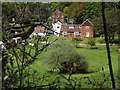
By Chalk Pit Farm
Deep and sheltered valley at the mouth of a disused chalk pit, Odiham.
http://www.odiham.eu/
Image: © Colin Smith
Taken: 12 May 2012
0.08 miles
4

Odiham, By the Chalk Face
Housing development at the edge of a deep and disused chalk pit beside the Alton Road.
Image: © Colin Smith
Taken: 12 May 2012
0.08 miles
5

The Crown, Odiham
On the B3349 Alton Road and also shown from the other direction in http://www.geograph.org.uk/search.php?i=87398091 ; no longer a restaurant or a pub. The Odiham to Alton Road will be forever linked in my mind to an astonishing cloudburst we drove through when I was young.
Image: © Derek Harper
Taken: 17 Sep 2018
0.08 miles

7

The Crown, Odiham
Former public house, converted to dwellings but still retaining the “Crown”sign, at right.
Image: © David Martin
Taken: 16 Oct 2025
0.10 miles

9
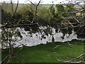
Disused Chalk Pit
Industrial heritage at Odiham where a deep dead end valley has been closed off.
Image: © Colin Smith
Taken: 12 May 2012
0.12 miles
10

Victorian postbox, Odiham
There's no plate and no number on this Victorian postbox on the Alton Road just south of Western Cross, just a torn notice about altered collection times from 15th September 2014, so the postbox is no longer in use. The number was in fact RG29 147.
Image: © Derek Harper
Taken: 17 Sep 2018
0.13 miles