
IMAGES TAKEN NEAR TO
Tunnel Lane, HOOK, RG29 1JT
Introduction
This page details the photographs taken nearby to Tunnel Lane, RG29 1JT by members of the Geograph project.
The Geograph project started in 2005 with the aim of publishing, organising and preserving representative images for every square kilometre of Great Britain, Ireland and the Isle of Man.

There are currently over 7.5m images from over14,400 individuals and you can help contribute to the project by visiting https://www.geograph.org.uk
Image Map
Images are licensed for reuse under creativecommons.org/licenses/by-sa/2.0
Notes
- Clicking on the map will re-center to the selected point.
- The higher the marker number, the further away the image location is from the centre of the postcode.
Image Listing (75 Images Found)
Images are licensed for reuse under creativecommons.org/licenses/by-sa/2.0
Image
Details
Distance
1

Clinic in North Warnborough
This building has had a number of uses and is now a clinic. the road is extremely busy in peak times as it is near J5 of the M3.
Image: © Graham Clutton
Taken: 2 Jan 2006
0.05 miles
2

The narrow part of North Warnborough Street
Image: © Bikeboy
Taken: 12 Oct 2013
0.07 miles
3
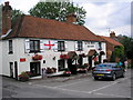
The Swan, North Warnborough, Hampshire
A splendid local which adjoins the now-restored Basingstoke Canal. Although the St George flag is still displayed, England were already out of the World Cup by the time this photograph was taken.
Image: © Dr Neil Clifton
Taken: 6 Jul 2006
0.08 miles


6
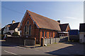
North Warnborough - Methodist Chapel
This chapel was built in 1895 and is located on Hook Road.
Image: © Chris Talbot
Taken: 6 Apr 2012
0.09 miles
7
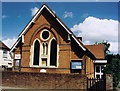
North Warnborough Methodist Chapel
Built in 1895.
Image: © Michael FORD
Taken: Unknown
0.09 miles
8

Basingstoke Canal in North Warnborough
The canal was completed in 1794 to provide a link for the transport of agricultural produce from Hampshire to London and ran from Basingstoke to the Wey Navigation Image, a distance of about 60 kilometres, or about 37 miles. After it fell into commercial disuse and eventual dereliction after the end of the Second World War, the first 51 kilometres, or 32 miles were restored by volunteers, and the canal was re-opened as far as Greywell in 1991.
This is the view looking towards Greywell from the Swan Bridge in North Warnborough. The water in the canal is extremely clear here.
Image: © Nigel Cox
Taken: 19 Nov 2008
0.11 miles
9

North Warnborough - Basingstoke Canal
The Basingstoke Canal on its way to Odiham.
Image: © Chris Talbot
Taken: 6 Apr 2012
0.11 miles
