
IMAGES TAKEN NEAR TO
Poplar Green, READING, RG2 8JY
Introduction
This page details the photographs taken nearby to Poplar Green, RG2 8JY by members of the Geograph project.
The Geograph project started in 2005 with the aim of publishing, organising and preserving representative images for every square kilometre of Great Britain, Ireland and the Isle of Man.

There are currently over 7.5m images from over14,400 individuals and you can help contribute to the project by visiting https://www.geograph.org.uk
Image Map
Images are licensed for reuse under creativecommons.org/licenses/by-sa/2.0
Notes
- Clicking on the map will re-center to the selected point.
- The higher the marker number, the further away the image location is from the centre of the postcode.
Image Listing (8 Images Found)
Images are licensed for reuse under creativecommons.org/licenses/by-sa/2.0
Image
Details
Distance
1

Pascal Crescent, Shinfield
The edge of the Shinfield Park development viewed from the lightly wooded periphery of Nores Hill Wood.
Image: © Andrew Smith
Taken: 3 Apr 2019
0.10 miles

3

Back of Wakefield Cottage
Magnificent and spacious home of historical interest having been the former headquarters of the RAF flying training command 1940-1968. Now Grade II listed.
The Lodge has been beautifully restored to former glory after years of neglect following its closure after being a major part of the RAF's history. Originally built as a substantial family home the property was adopted by the RAF in 1940 and used throughout World War II as a command centre for RAF flying training, known as RAF Shinfield Park. After its closure on 1968 the property eventually fell into disrepair until refurbished
Image: © Roger Templeman
Taken: 12 May 2014
0.17 miles
4
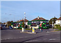
A Pair of Fives
This turnaround at the southern end of Northumberland Avenue is the end of Reading Buses' route Five.
The buses are colour coded for the route they do. You won't see a pink bus round here, they go north of the river.
Image: © Des Blenkinsopp
Taken: 13 Nov 2013
0.22 miles
5
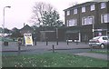
Whitley Wood
The whole square is occupied by a 1960s and 70s peripheral council estate. Here is the shopping centre.
Image: © Rosalind Mitchell
Taken: 28 Apr 2005
0.22 miles
6
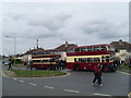
Two preserved Reading buses at the Northumberland Avenue terminus (1)
This photo shows former Reading buses 47 (RD 7127) and 4 (MRD 147) at the Northumberland Avenue terminus of the former trolleybus route 15 which was converted to motorbus operation at the end of December 1967. Northumberland Avenue can be seen to the left of the photo.
Image: © David Hillas
Taken: 2 Apr 2011
0.23 miles
7

Two preserved Reading buses at the Northumberland Avenue terminus (2)
At the Northumberland Avenue terminus of former trolleybus route 15 are two preserved Reading AEC Regent motorbuses 4 (MRD 147) ahead of 47 (RD 7127). Reading Buses now operates route 5 to this terminus as indicated on the top of the bus stop to the right of the photo. The street lighting in the photo uses former trolleybus traction poles with extensions above them.
Image: © David Hillas
Taken: 2 Apr 2011
0.23 miles
8

Bus waiting at the Northumberland Avenue terminus
A Reading Transport Scania OmniDekka bus 807 (YN54 AEY) is seen waiting at the terminus in Northumberland Avenue near Whitley Wood Road on route 5 for Reading Station via Corbridge Road. It is painted in Green livery with the figure 5 seen on the front and side. The vehicle has East Lancs 90-seater bodywork dating from 2004.
Image: © David Hillas
Taken: 2 Apr 2011
0.23 miles