
IMAGES TAKEN NEAR TO
Lacewood Gardens, READING, RG2 8JW
Introduction
This page details the photographs taken nearby to Lacewood Gardens, RG2 8JW by members of the Geograph project.
The Geograph project started in 2005 with the aim of publishing, organising and preserving representative images for every square kilometre of Great Britain, Ireland and the Isle of Man.

There are currently over 7.5m images from over14,400 individuals and you can help contribute to the project by visiting https://www.geograph.org.uk
Image Map
Images are licensed for reuse under creativecommons.org/licenses/by-sa/2.0
Notes
- Clicking on the map will re-center to the selected point.
- The higher the marker number, the further away the image location is from the centre of the postcode.
Image Listing (27 Images Found)
Images are licensed for reuse under creativecommons.org/licenses/by-sa/2.0
Image
Details
Distance
1

A327 Shinfield Road
Heading towards central Reading.
Image: © Robin Webster
Taken: 22 Aug 2020
0.04 miles

3

Benchmark in #2 Whitley Wood Road
Ordnance Survey cut mark benchmark described on the Bench Mark Database at http://www.bench-marks.org.uk/bm58994
Image: © Roger Templeman
Taken: 16 Jul 2014
0.05 miles
4

#2 Whitley Wood Road
There is an OS benchmark Image inside the extension on the right hand side of the house
Image: © Roger Templeman
Taken: 16 Jul 2014
0.05 miles
5

Shinfield Road at the junction of Shinfield Rise
Image: © David Howard
Taken: 6 Mar 2016
0.10 miles

7
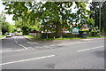
Junction of Shinfield Road and Halls Lane
Image: © Roger Templeman
Taken: 12 May 2014
0.13 miles
8

Shinfield Road, Reading
This is the A327 about a hundred yards inside the boundary of Reading. There are a few shops, two pubs and the petrol station.
Image: © Andrew Smith
Taken: 3 Dec 2007
0.13 miles
9

Whitley shops - Shinfield Road
This is the Shinfield Road (A327) dividing Whitley and Earley. There are a variety of shops and pubs in the vicinity.
Image: © C D Uglow
Taken: 12 Aug 2005
0.13 miles
10

The Sainsbury Arms?
Another pub turned into a supermarket.
Image: © Des Blenkinsopp
Taken: 23 Sep 2014
0.14 miles