
IMAGES TAKEN NEAR TO
Northumberland Avenue, READING, RG2 7PW
Introduction
This page details the photographs taken nearby to Northumberland Avenue, RG2 7PW by members of the Geograph project.
The Geograph project started in 2005 with the aim of publishing, organising and preserving representative images for every square kilometre of Great Britain, Ireland and the Isle of Man.

There are currently over 7.5m images from over14,400 individuals and you can help contribute to the project by visiting https://www.geograph.org.uk
Image Map
Images are licensed for reuse under creativecommons.org/licenses/by-sa/2.0
Notes
- Clicking on the map will re-center to the selected point.
- The higher the marker number, the further away the image location is from the centre of the postcode.
Image Listing (41 Images Found)
Images are licensed for reuse under creativecommons.org/licenses/by-sa/2.0
Image
Details
Distance
1
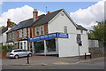
The Reading Angling Centre, #69Northumberland Avenue
Junction of Northumberland Avenue and Newcastle Road
Image: © Roger Templeman
Taken: 6 May 2014
0.08 miles

3
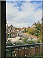
Clent Road from Phoebe Cusden House
Clent Road is off Basingstoke Road in Whitley. Phoebe Cusden House is a block of supported living accommodation.
Image: © Oscar Taylor
Taken: 28 Aug 2019
0.14 miles
4

Benchmark on gatepost at entrance to Cintra Park
Ordnance Survey cut mark benchmark described on the Bench Mark Database at http://www.bench-marks.org.uk/bm54234
Image: © Roger Templeman
Taken: 6 May 2014
0.15 miles
5

Entrance to Cintra Park from Cintra Avenue / Warwick Road junction
There is an OS benchmark Image at the base of the right hand gatepost
Image: © Roger Templeman
Taken: 6 May 2014
0.15 miles
6
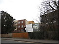
New development on Basingstoke Road, Reading
According to the map this was an open space so another example of filling in green spaces in already overcrowded urban areas.
Image: © David Howard
Taken: 6 Mar 2016
0.15 miles
8

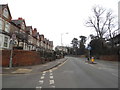
Old Boundary stone by the B3031, Basingstoke Road
Carved stone post by the B3031 (was A33), in parish of Reading (Reading District), Basingstoke Road; opposite No.52, and Bourne Avenue, on boundary of Telecom Building, was in wall of house opposite Bourne Ave, now in pavement with back to wooden fence, on East side of road. Reading half-round stone, erected by the Reading & Basingstoke turnpike trust in the 19th century. Hidden by ivy in 2021.
No inscription visible.
Milestone Society National ID: BE_RGBS01
Image: © A Rosevear
Taken: 16 Sep 2003
0.16 miles

10

Bus on the Corner
Reading buses are colour coded for the route they do.
Image: © Des Blenkinsopp
Taken: 5 Jul 2012
0.16 miles