
IMAGES TAKEN NEAR TO
Shinfield Road, READING, RG2 7DZ
Introduction
This page details the photographs taken nearby to Shinfield Road, RG2 7DZ by members of the Geograph project.
The Geograph project started in 2005 with the aim of publishing, organising and preserving representative images for every square kilometre of Great Britain, Ireland and the Isle of Man.

There are currently over 7.5m images from over14,400 individuals and you can help contribute to the project by visiting https://www.geograph.org.uk
Image Map
Images are licensed for reuse under creativecommons.org/licenses/by-sa/2.0
Notes
- Clicking on the map will re-center to the selected point.
- The higher the marker number, the further away the image location is from the centre of the postcode.
Image Listing (29 Images Found)
Images are licensed for reuse under creativecommons.org/licenses/by-sa/2.0
Image
Details
Distance
1

#172 Shinfield Road
There is an OS benchmark Image on the side of the house at its front corner, left of the black downpipe
Image: © Roger Templeman
Taken: 12 May 2014
0.03 miles
2

Benchmark on #172 Shinfield Road
Ordnance Survey cut mark benchmark described on the Bench Mark Database at http://www.bench-marks.org.uk/bm57351
Image: © Roger Templeman
Taken: 12 May 2014
0.03 miles
3

Houses in Shinfield Road
Shinfield Road is one of the main thoroughfares running into Reading from the south in this image. Largely residential but with the open spaces of school and university grounds to the east.
Image: © Natasha Ceridwen de Chroustchoff
Taken: 5 Mar 2008
0.06 miles
4

Spring blossom in Shinfield Road
Houses here are set in generous gardens; across the road, school playing fields and a small housing estate.
Image: © Natasha Ceridwen de Chroustchoff
Taken: 5 Mar 2008
0.07 miles
5

#194 Shinfield Road / #1 Beech Road semi-detached pair
There is an OS benchmark Image on the front of the left hand house behind the join of the wooden gates
Image: © Roger Templeman
Taken: 12 May 2014
0.08 miles
6

Benchmark on #194 Shinfield Road
Ordnance Survey cut mark benchmark described on the Bench Mark Database at http://www.bench-marks.org.uk/bm57350
Image: © Roger Templeman
Taken: 12 May 2014
0.08 miles
7

Sycamore Road houses
This is the view west across a Shinfield Road garden to Sycamore Road that runs parallel.
Image: © Natasha Ceridwen de Chroustchoff
Taken: 5 Mar 2008
0.09 miles
8
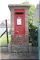
Pillar letter box with benchmark, Linden Road
Ordnance Survey cut mark benchmark described on the Bench Mark Database at http://www.bench-marks.org.uk/bm57349
Image: © Roger Templeman
Taken: 12 May 2014
0.10 miles
9

Linden Road houses and pillar letter box from Hazel Crescent
There is an OS benchmark Image on the front face of the letter box pillar
Image: © Roger Templeman
Taken: 12 May 2014
0.10 miles
10

Electricity substation on north side of Cressingham Road
There is an OS benchmark Image on the front of the building near its right hand corner
Image: © Roger Templeman
Taken: 12 May 2014
0.17 miles